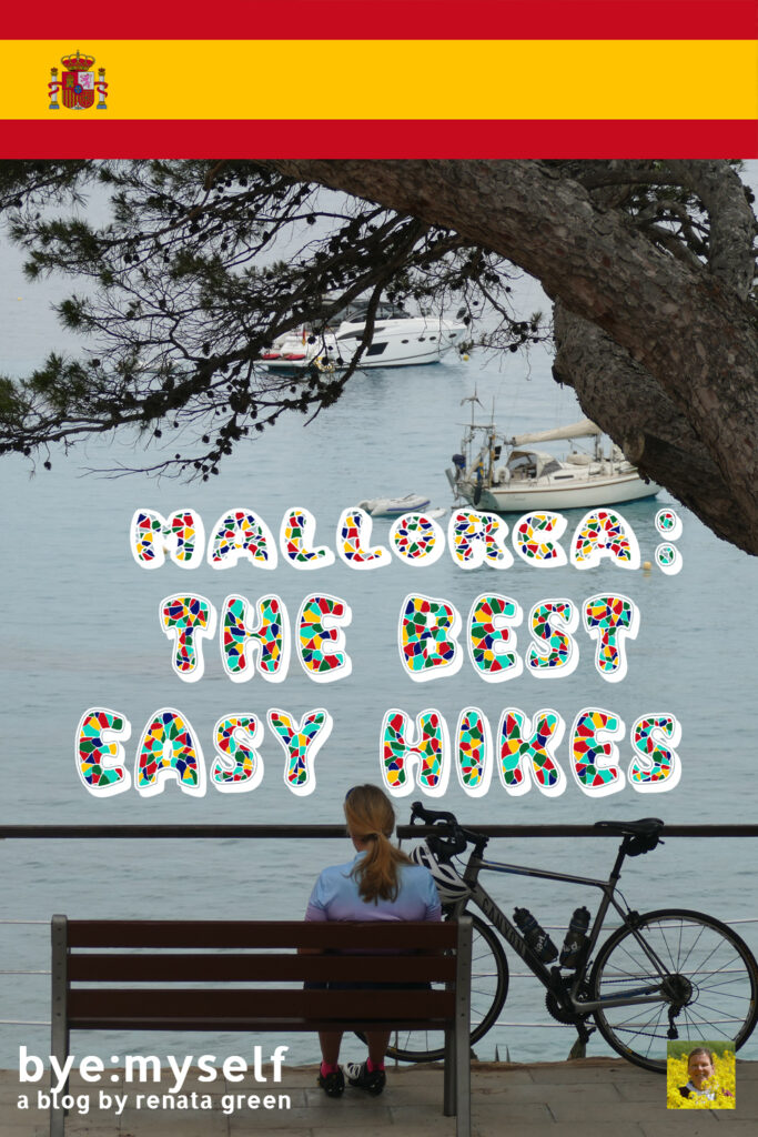
Yes, Mallorca does have beautiful beaches, but since the hinterland is not to be missed, follow my footsteps on some of the best – and at the same time very easy – hikes.
Mallorca
The island of Mallorca is the largest of the Balearic Islands, about 170 kilometers off the coast near Barcelona. The Balearics consist of Menorca, Cabrera, Ibiza, Formentera, and Mallorca, obviously. Yet, in addition to these five inhabited islands, there are also 146 uninhabited keys.
Like the other Balearic Islands, Mallorca belongs geologically to the Andalusian Fold Mountains. Because of their marine origin, the rocks are rich in limestone and contain many fossils. Also, the predominant limestone rocks are easily soluble in water.
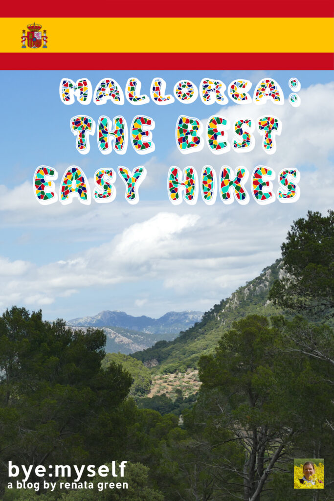
However, Mallorca’s mountain regions, the largely unpopulated Serra de Tramuntana in the northwest and the less spectacular Serres de Llevant in the east, mainly contain dolomite. Yet, the Serres de Llevant also contains marl, which causes faster erosion in the eastern part of the mountains. Consequently, today, this mountain range is much lower than the Serra de Tramuntana in the northwest.
Nature’s Treasures
In 2011, UNESCO declared the Serra de Tramuntana a World Heritage Site. This way, they acknowledged the symbiosis between natural and human factors that over the centuries has had a strong impact on the traditions and culture.
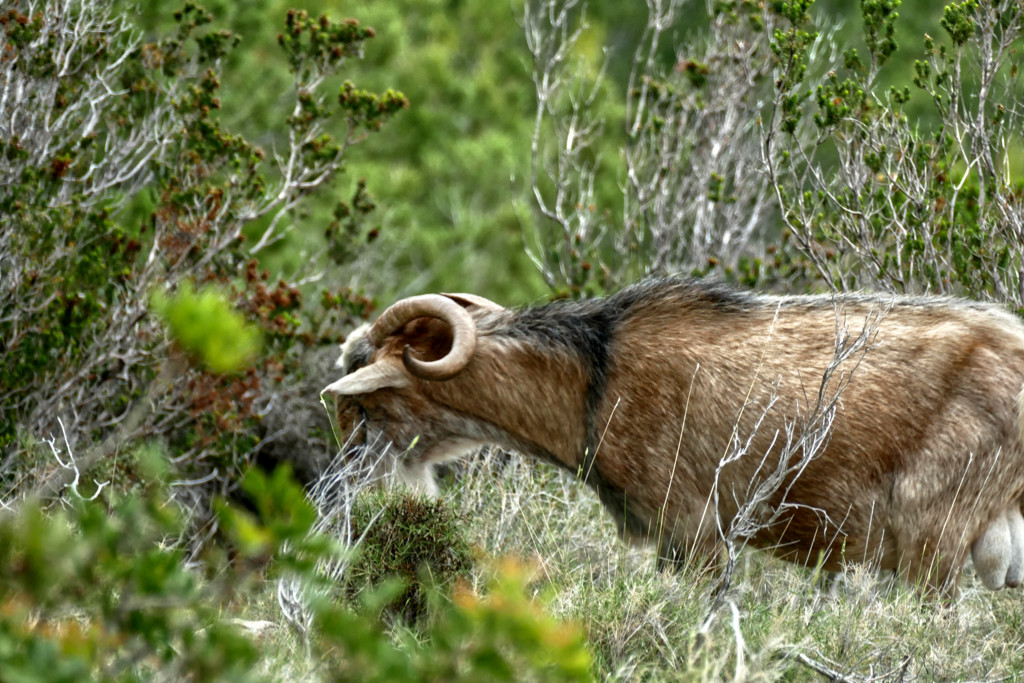
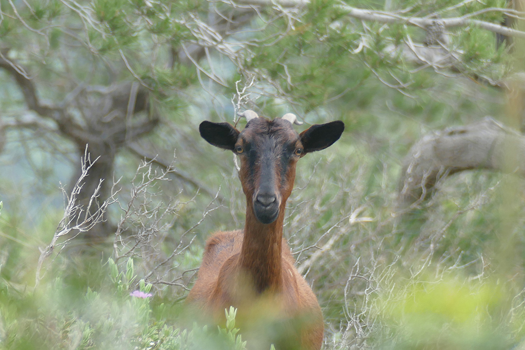
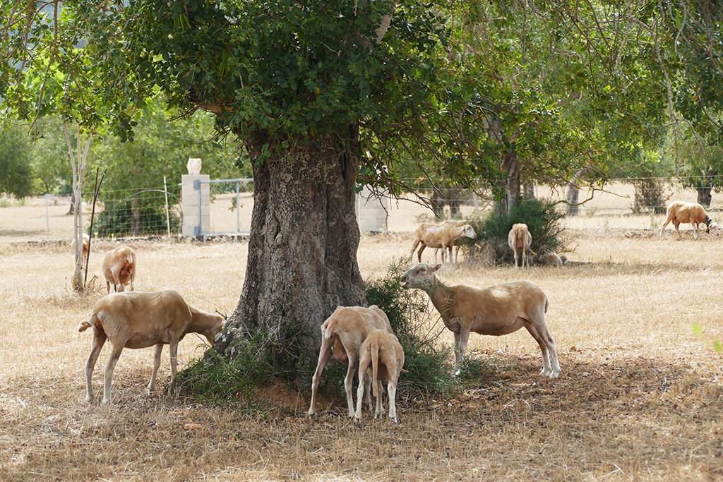
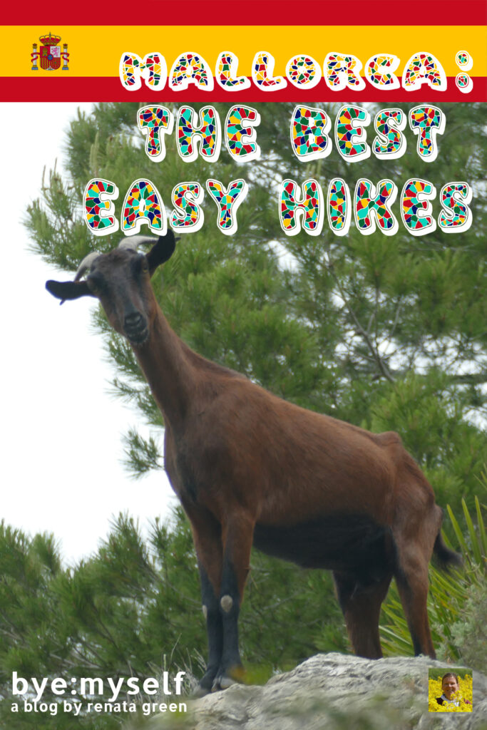
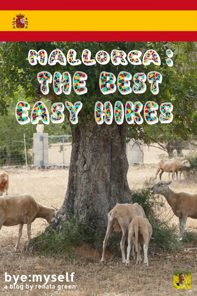
Mallorca has a lush flora of over 1,500 species. The fauna, however, is less rich and includes only a few mammals. The only larger mammals living in the wild are feral goats. You’ll probably run into some of them on your hikes.
However, there are many bird species. In the Albufera wetland live purple grouse and crested coots as well as egrets and bitterns. Black vultures inhabit the Tramuntana mountains, and pink flamingos the salt flats in the southwest of the mesmerizing Calas.
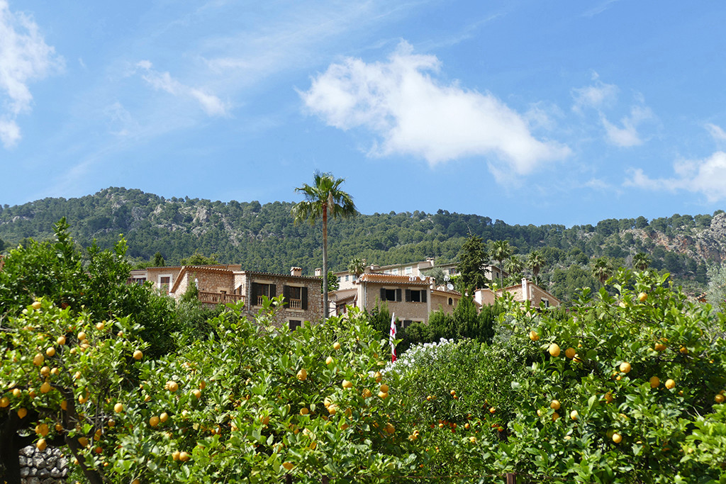
During my trip to Mallorca, I stayed in the capital city Palma. It was the best gateway to the island’s many amazing hiking grounds. However, since Mallorca has an east-west extension of 98 kilometers and a north-south extension of 78 kilometers, you can follow my footsteps on all these beautiful trails, no matter where on the island you’re based.
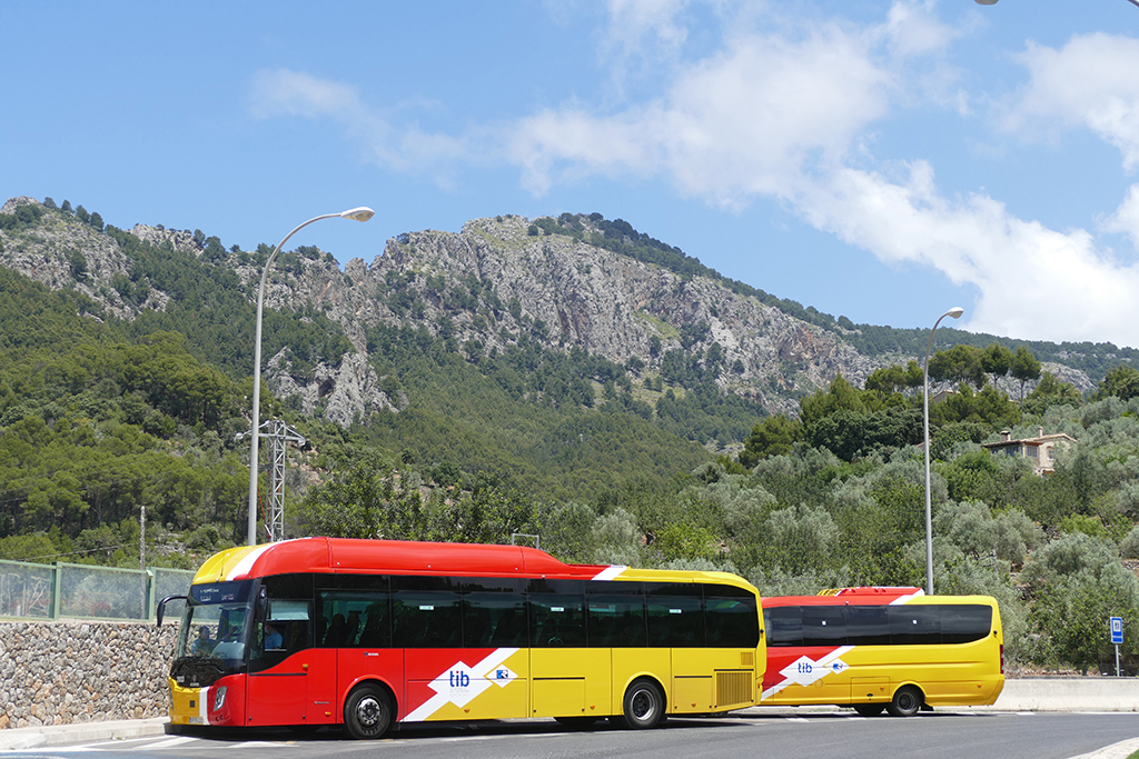
I’d also like to point out that I’m not driving. But since Mallorca has a pretty amazing, comprehensive network of public transportation, going everywhere I needed to go was a piece of cake.
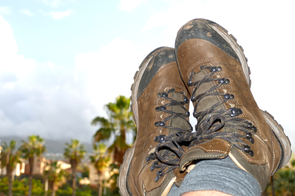
But enough with all these general explanations – you’ll get more information and tips at the end of this post, anyway. Tie your hiking shoelaces properly, and let’s hit those mesmerizing trails.
What to Know Before You Go
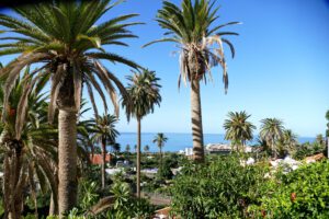
Exploring parts of Mallorca by hiking, you will discover the picturesque unity of the sea and the mountains, as well as the local flora and fauna. You’ll gain totally new perspectives of the valleys and mountain villages – literally and metaphorically.
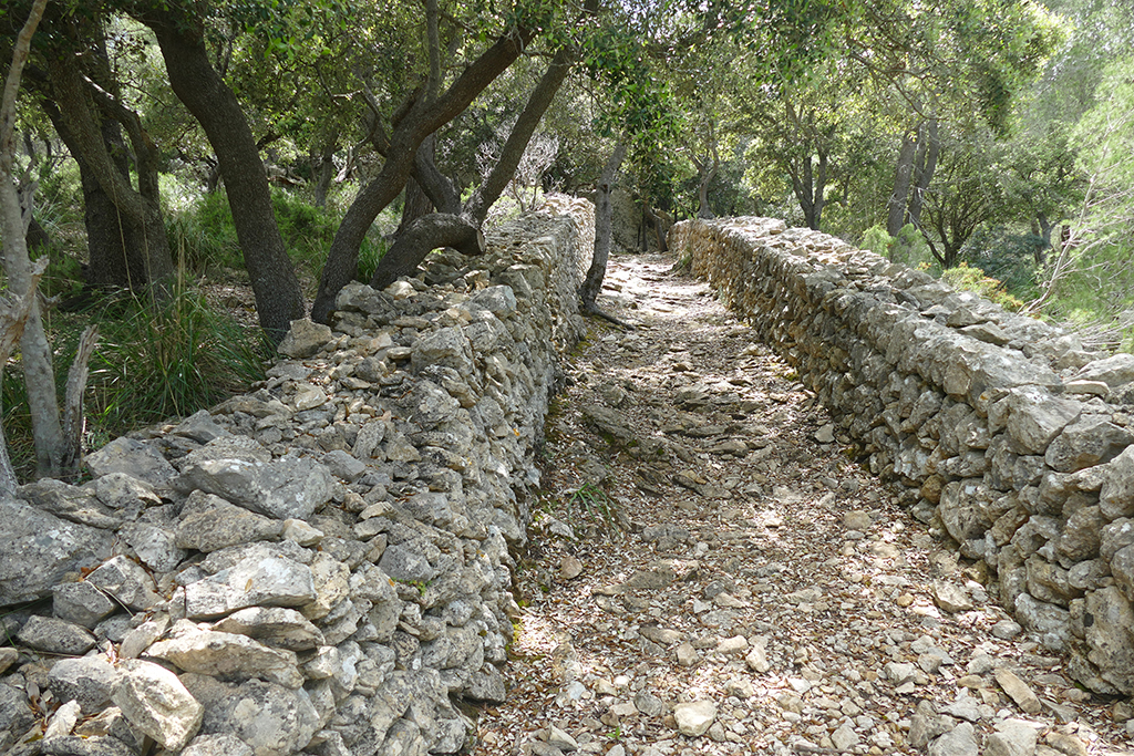
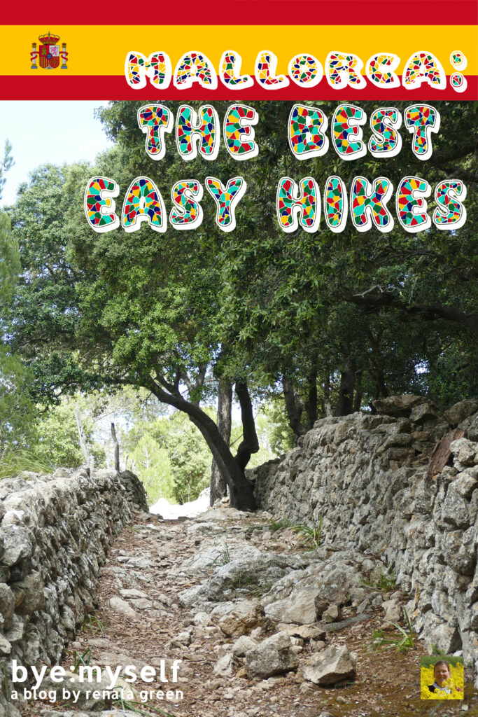
Mallorca’s long-distance hiking trail, the so-called Ruta de Pedra en Sec, hence, the dry stone route, is certainly the highlight for passionate hikers. However, there is a whole lot to discover even for less experienced wanderers.
Mallorca’s Mediterranean climate makes hiking pleasant all year round. Yet, the island’s coolest and rainiest region is the Serra de Tramuntana mountain range.
The best time to hike is actually during the almond blossom season from February to the end of May.
In Mallorca, you will rarely find well-marked hiking trails, even on the long-distance hiking trail GR 221. Although hiking routes are usually well-developed, they often lead across private territories.
Nevertheless, many landowners allow individual hikers on their grounds. Yet, if you meet a landowner, it doesn’t hurt to ask whether you can cross the property: ¿Se puede pasar?
If you see signs saying something like Prohibit pasar or Prohibido el paso, trespassing is prohibited.
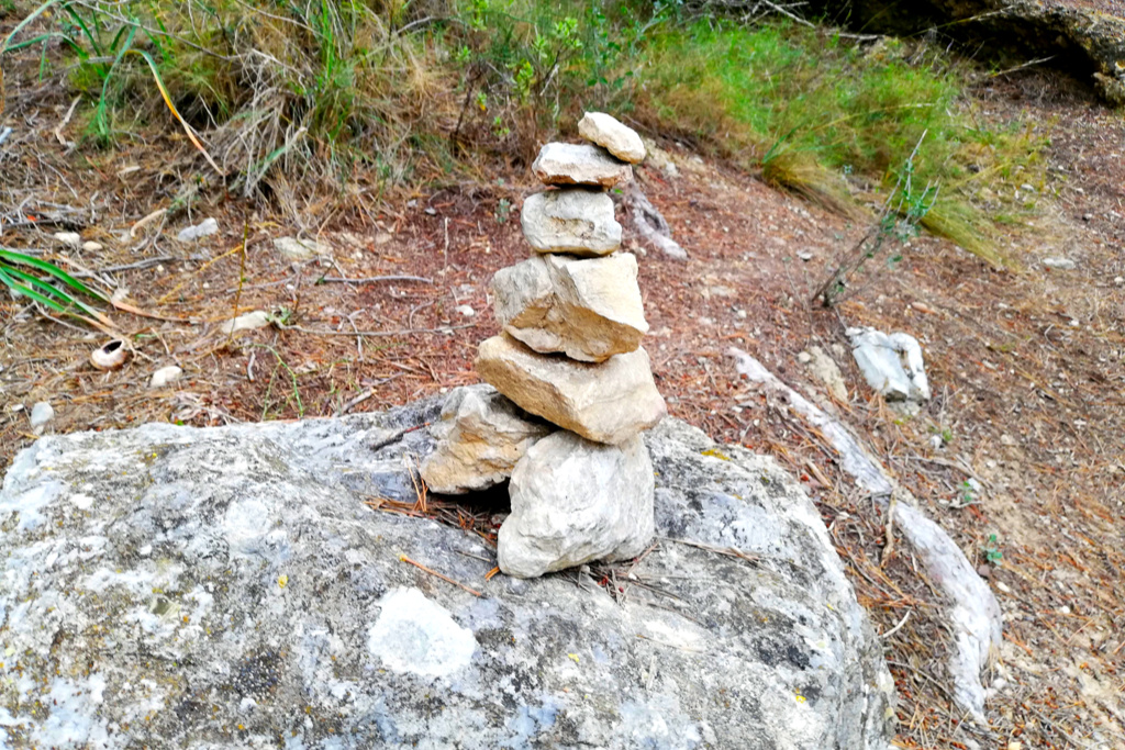
Many trails are marked with cairns, colored dots, or even wooden signs. Still, sometimes you have to look carefully to note the stones in the tall grass or in the rugged rocky terrain. Hence, it doesn’t hurt to have the hiking maps I’m adding below for you. Also, GPS is a useful tool for longer tours.
Easy Hikes
On the Barefoot Trail of Puigpunyent
How to Get There
The village of Puigpunyent is only 15 kilometers west of the capital. By car, you leave Palma on the Ma-0141 and get there in less than half an hour. If you take the bus, as I did, you can take bus #201 from the Estació Intermodal towards Galilea. After six stops and half an hour, you arrive at the bus stop in Puigpunyent.
During the week, there are nine buses per day, on weekends, there are only five. Therefore, if you go on a Saturday or Sunday, mind you that there is a bus #201 in the morning at 9.15 a.m. You then arrive in Puigpunyent at 9.40 a.m. The first opportunity back to Palma is already at 1.15 p.m.
They say that the hike takes about three hours, so you should be fine. Nevertheless, if you take a longer break or too many photo stops, it can get really tight, and if you miss this one, you have to wait for the next one for three and a half hours till 4.50 p.m.
Therefore, if it’s not too hot, I’d suggest you take the #201 to Puigpunyent at 12.45 p.m. so that you start your hike there at 1.10 p.m. This way, you have almost four hours to make it back by bus at 4.50 p.m. And even if you miss that one, the following one leaves at 6.15 p.m., so that your wait will be just long enough for a refreshment at one of Puigpunyent’s cute cafés or bars.
However, you’ll find a great system map, timetables, and further useful information on this website.
Prepare for…
…a route of about ten kilometers in total with a net walking time of around three hours. I’m not a fast hiker and also wanted to take many pictures, therefore, I needed around 3.5 hours. I made it in time for the bus at 4.50 p.m. – see below – but it was really tight. The high difference will be approximately 400 meters.
During your hike, every time you’re in doubt about which way to go, there will be either a red dot, a directional arrow, or even a real sign – it’s almost like magic.
The walk is quite easy and the trails are in good condition, hence, good sneakers with a profiled sole should do. Nevertheless, it’s always better to wear hiking boots with high shafts that also protect your ankles.
Ready, Steady, Go
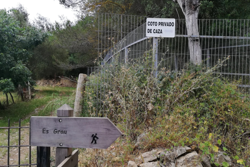
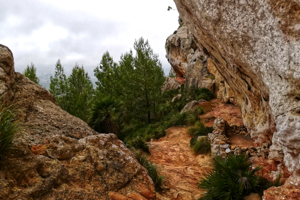
The hike begins at the northern side of Puigpunyent at the Carretera Esporles. Here you can walk up the Ma-1101 road following the signs Es Grau and Esporles. In a left bend, you will turn right onto a stony footpath at the sign Es Grau. This leads slightly uphill to a larger property.
Follow a red dot straight ahead at the property and continue up the path through a sparse pine forest. Eventually, the route continues upwards partly on the road and on stony paths that branch off from the Ma-1101 several times – mind the arrows. Hiking on the road, be prepared for some really crazy drivers – that you normally can already hear coming roaring from afar. Still, be careful.
Finally, after around 35 minutes past the property, you will reach the Coll des Grau. There you hike down about 100 meters and turn left at the sign Puigpunyent, Son Fortesa.
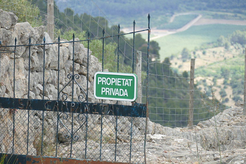
You enter the property through an iron gate, and later you’ll also pass the entrance gate of the Sa Comuna de Superna. Now follow the sign Sa Campaneta, and after about ten minutes, you’ll see the entrance gate of the homonymous estate. Don’t worry about the signs Propiedad Privada – private property – and Camí Particular – private road – access is allowed.
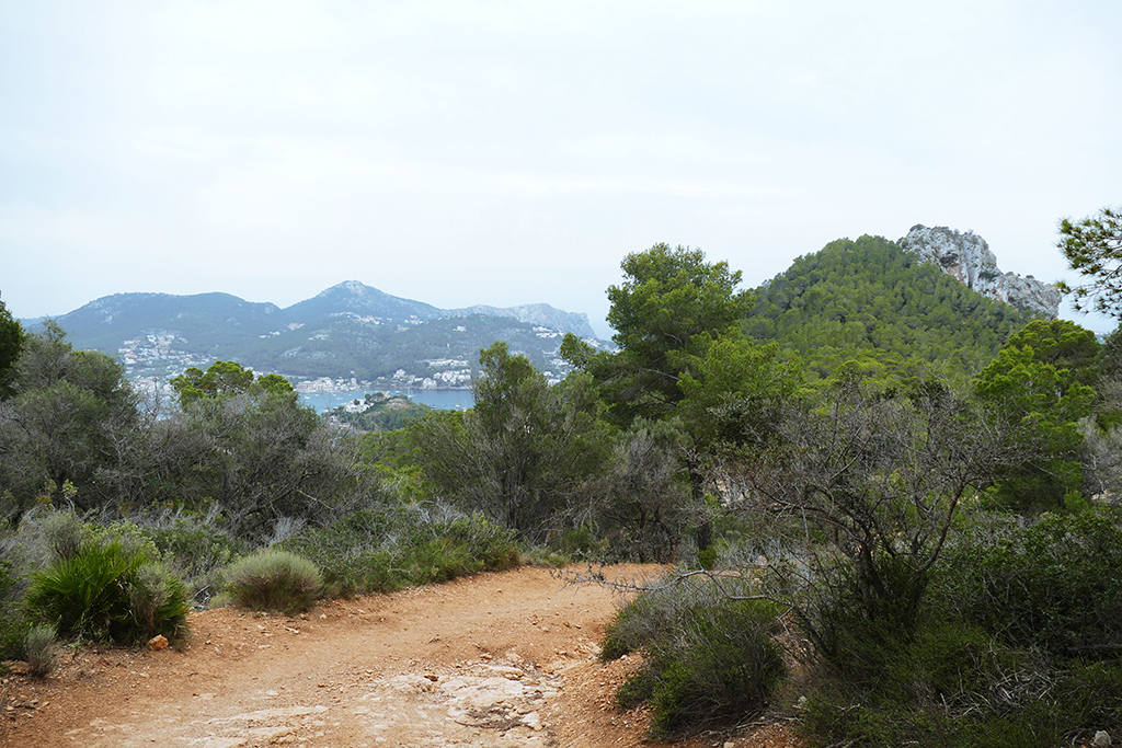
Hike with a View
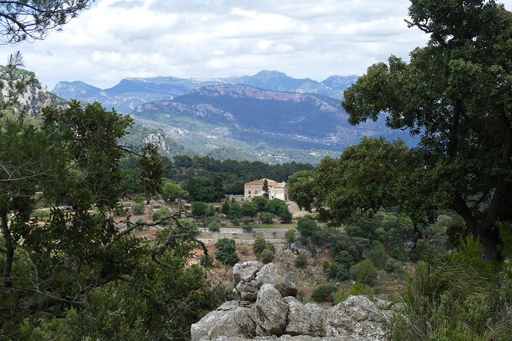
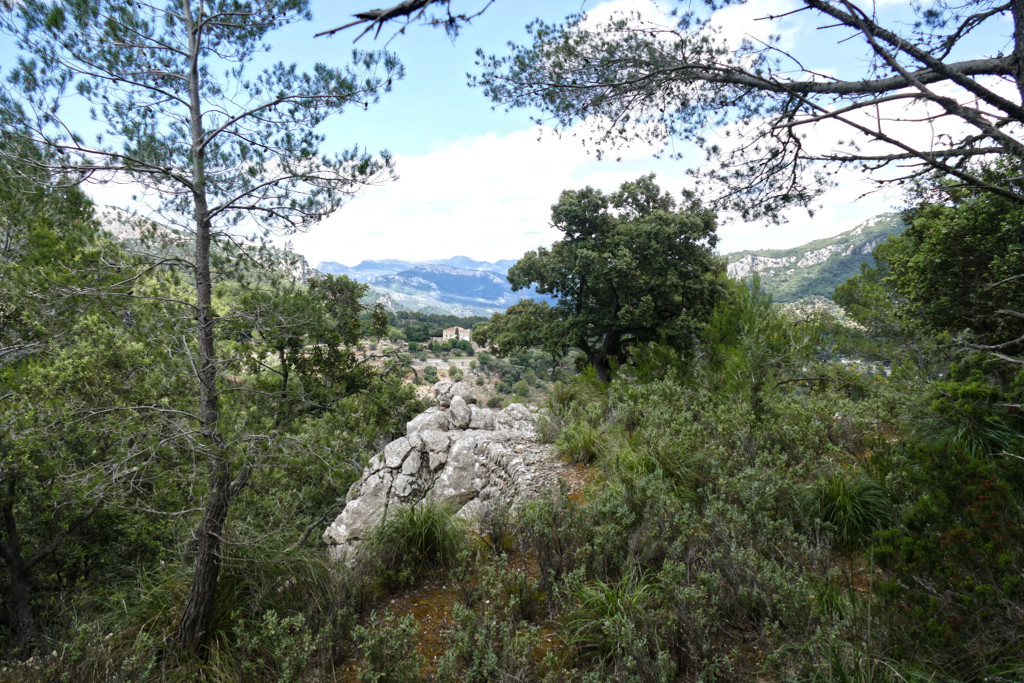
This will probably be your first extended photo stop since the view here is impressive. On the right, the panorama sweeps from the Serra des Puntals over the Mola de Son Ferrandell, the Talaia Vella near Valldemossa, to the Teix massif. The Puig de Galatzó and the Puig de na Bauçà rise to the left. You can even spot the sea at Santa Ponça.
Continue on the wide slope which ascends moderately. At a bifurcation, follow the directional arrow, pass a wall passage, then an open iron gate, and turn left at the sign Puigpunyent, Son Fortesa. A little later, there is a left turn at a post arrow and a red marking.
A paved path now leads up to a larger plain on the right of the path and later to a wall passage.
Behind the breach, there is a forest path going downhill. A sign indicates that you are now in a hunting area.
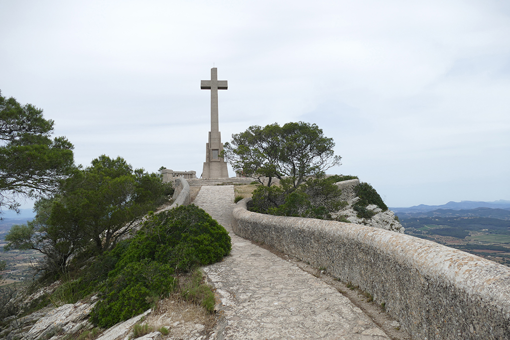
At a bifurcation, follow the arrow, and about ten minutes after the breach in the wall, you’ll get to a place where a stone pyramid and a red arrow point to a path to the left. This trail leads to the Ermita de Sant Onofre.
Remnants from the Past
The hermitage, which today is in ruins, was built in 1660. For about 30 years, monk Jaume Català lived at the Ermita. Eventually, farmer Francesc Llinàs lived here from 1917 to 1934 and worked the terraces around the Ermita with his parents.
Now go back to the main path and turn left. The slope then leads past a lime kiln. At a later fork in the road, turn left – according to the arrow – and you reach the Trescollet saddle.
There is a plaque on the saddle showing the old path from Estellencs. Until 1913, this Camí Vell d’Estellencs was the only connection between Estellencs and Puigpunyent.
From the Trescollet saddle, continue straight on the wide slope that ascends into the valley. As you reach crossings, you follow the cairns, arrows, and red dots. You’ll pass a gap in the wall and then another wall passage. Here you continue straight, and a bit later you pass the former mountain Finca Sa Muntanya. Following the arrow, you’ll get to the old Sa Teulera brickworks.
An arrow shows you where to turn right onto a shortcut trail that leads back to the main path. Descending, you get to a fence, and turn left. About 100 meters further, a slatted frame to your right serves as a gate. Climb through it and close it after yourself – yes, even a little sign tells you so…those Mallorquins are rustic yet thorough. Now you find yourself on the road to the Possessió Son Fortesa.
Keep on walking on the comfortable road, and you’ll get back to the northern tip of Puigpunyent, where your beautiful hike began.
Map
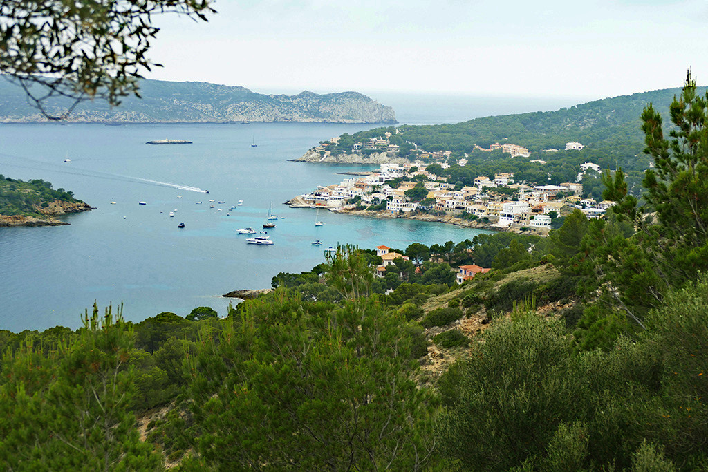
From Port d’Andratx to Sant Elm
How to Get There
The hike begins on the outskirts of Port d’Andratx, a posh harbor about 32 kilometers west of Palma. By car, you leave Palma on the Ma-01 and get there in a bit more than half an hour. If you go there by public transport, as I did, you can take bus #101 from the Estació Intermodal. This ride takes about 50 minutes. Between 6.46 a.m. and 9 p.m., buses go more or less hourly – even on Sundays.
If, after your hike to Sant Elm, you don’t want to make it back walking, you can take bus #121 from Sant Elm to Port d’Andratx as well as Andratx. From there, you take bus #101 to Palma. However, bus #121 circulates between 7.15 a.m. and 8.25 p.m.
You’ll find a great system map, timetables, and further useful information on this website.
Prepare for…
…a route of about nine kilometers in total with a net walking time of around three hours. The high difference will be approximately 300 meters.
The walk is quite easy. Most of the paths are in good condition, hence, good sneakers with a profiled sole should do. Nevertheless, it’s always better to wear hiking boots with high shafts that also protect your ankles. The only slightly critical moment is when you have to get over the summit next to the broadcasting tower. The right spot is about 150 meters behind the tower, and unfortunately not that easy to find.
Ready, Steady, Go
The hike to Sant Elm starts close to the yacht club at Port d’Andratx. Coming from the village on the Avinguda de Gabriel Roca i Garcías, turn right into Carrer Aldea Blanca Calle and at the next bifurcation, left into the Carrer de Cala d’Egos. First, this asphalted road is winding uphill in serpentines. Later, it becomes a well-graded dirt road. This is actually the hardest yet least alluring part of the hike.
However, walkers can follow the marginally more interesting shortcut going straight up the hill.
Once you reach the top, turn right and follow a comfortable yet partly rocky, wide path. You are now in the countryside, from where you can enjoy many mesmerizing views.
Just continue on the trail. Keep your eye on the high broadcasting tower. Once you reach this mast, it gets a bit tricky since you have to find the right spot in a low stone fence. I was walking up and down like an idiot. One moment, I looked over the fence just to spot two free climbers. Nope, this was not the way I intended to descend.
Finally – and with the help of an Austrian hiker – I found the correct spot where I climbed over the knee-high wall to follow the trail over the Pas Vermeil, hence, the red path.
Descending to Sant Elm
As soon as you reach a dirt double track, you continue left towards Sant Elm. The trail then continues through some forests. There are cairns to guide you, but you really have to pay attention to spot them.
The trail towards St Elm eventually follows the coast, and finally, you will reach the village over some long, steep stairs.
After a break at Sant Elm, you can go back to Andratx by bus – or walking, if you like. Or you continue to the Sa Trappa Monastery.
Map
From Felanitx to the Sanctuary of Sant Salvador
How to Get There
Since Felanitx is on the route from Palma to Manacor, another important city, on weekdays, bus #501 goes approximately every hour. The ride takes a bit over an hour.
There are two stops in Felanitx. The first one is Polígon Felanitx, which is a bit on the outskirts. That’s where I got off, and then I had to walk all the way downtown. You do not make this mistake and get off at the following stop Ernest Mestre, which is right in the heart of the city.
If you don’t start your hike too late, you won’t have to worry about the ride back to Palma. As I said, it’s a highly frequented route with the last connection at 9.20 p.m.
You’ll find a great system map, timetables, and further useful information on this website.
Prepare for…
…a route of about seven kilometers, five of those going uphill. The net walking time should be about two hours each way max. The high difference is a bit over 500 meters.
The walk is not too hard, however, you’ll be climbing up quite steep trails. Although good sneakers with a profiled sole should do, it’s always better to wear hiking boots with high shafts that also protect your ankles.
Ready, Steady, Go
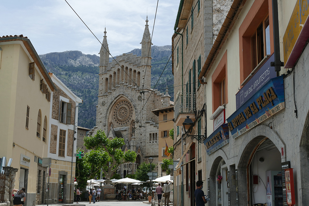
The walk starts in the city of Felanitx at the Parc Municipal de la Torre. It’s called a park, but don’t expect any greenery, it’s rather like a concrete soccer field. Anyway, you have to cross the park and continue on Carrer de Rocabertí eastwards. If you don’t have enough water with you, you can purchase some at the Park Café Restaurant. Your next opportunity to quench your thirst will be way up high at the Bar San Salvador.
Continue on the Carrer de Rocabertí and as you reach the first crossroad, just keep on walking straight ahead. You’ll get to an old factory and one of the old mills close to La Teringa dels Molins. Here you bear left.
Pass the old factory Can Farineta, the old mill, and some orchards. Every time you get to a crossroads, you go straight.
On the Road to Sant Salvador
This way, you advance eastwards between small farms and large, at that time of the year, quite dry fields. The street veers gently to the right until you finally reach road PMV-4011. From now on, you can basically just follow the long and winding main road.
However, as you are hiking, you don’t have to walk up in serpentines as cars and bikes do, but you can take quite steep shortcuts and ‘goat tracks’.
Halfway up the mountain is the Mare Déu del Bon Pastor chapel, short Sa Capelleta. According to legend, here, a shepherd found the statuette of the Mother of God.
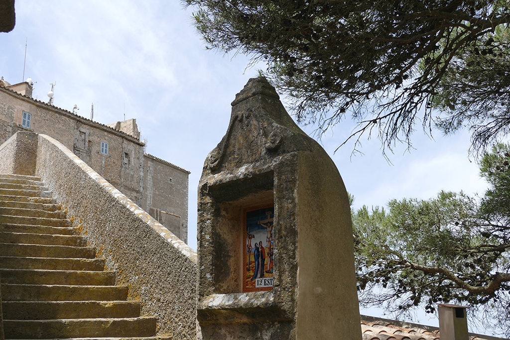
Opposite the chapel, you’ll spot the stairs that are the beginning of the old way of the cross. From here, you’ll pass 13 milestones with azulejos from the 16th century.
Milestones
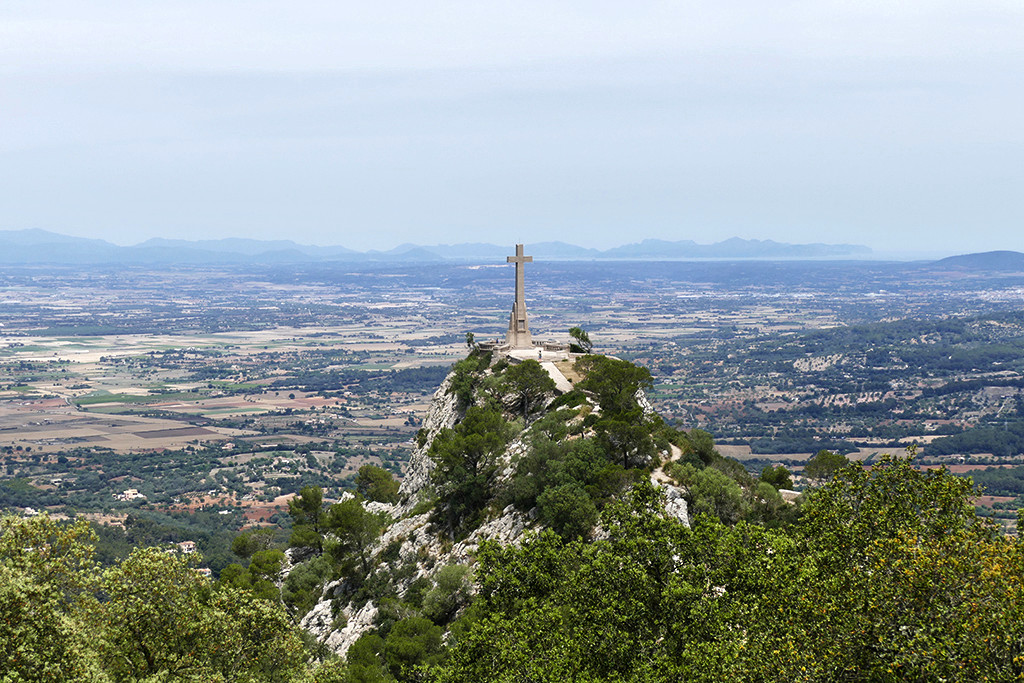
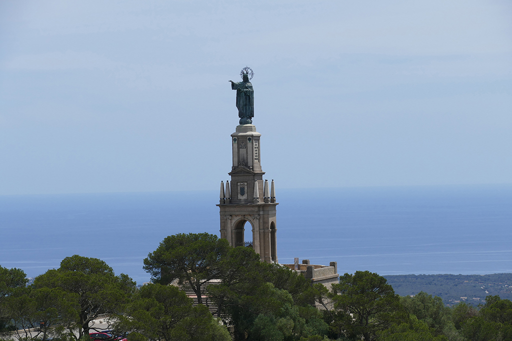
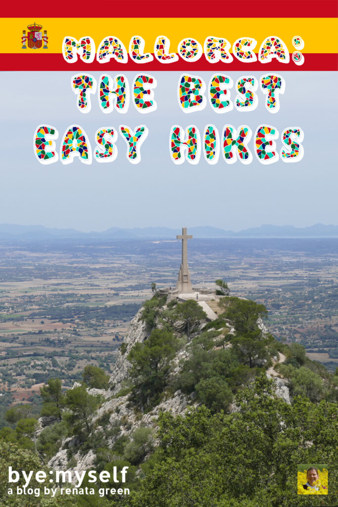
A couple of curves above the chapel is your first milestone, namely the Creu des Picot. As a matter of fact, this stone cross is on the summit of the Puig des Milá, a mountain about 250 meters above the plateau of the Puig de Sant Salvador.
A short, narrow footpath leads up to the cross. The stone cross is 14 meters high and was erected in 1957.
From here, you can either continue uphill on the road so that your next stop will be the iconic monument of Christ Pantocrator or Cristo Rei. The entire monument is 37 meters high as a 30-meter-high base carries a 7-meter-high sculpture of Christ made of blackened bronze.
Under the base of the monument, there is a chapel for prayer and meditation. It contains the remains of Canónigo D. Mateo Alzamora, who had commissioned the monument, as well as five hermits from the Santuari de Sant Salvador. Unfortunately, the chapel is not open to the public.
Another option is climbing up a dirt road straight up to the summit and visiting the Cristo Rei monument on your descent.
On the summit of Puig Sant Salvador, you can visit the Santuari de Sant Salvador, a former monastery and pilgrimage site, founded in 1348. Or you just sit outside the Bar Sant Salvador, enjoying a drink and the overwhelming views.
If you are an early riser or don’t depend on the last bus back to Palma, which leaves downtown Felanitx at 9.20 p.m., you’ll even have the option to enjoy the sunrise respectively sunset over Mallorca from the summit of Sant Salvador.
Map
From Sóller to Fornalutx
How to Get There
There are two direct buses between Palma and Sóller, #203 and #204.
#203 crosses the mountains, hence, the trip is more scenic, but it also takes longer.
On weekdays, the first bus #204 leaves Palma at 6.30 a.m. and reaches Sóller in less than an hour. Until 9 p.m., buses are going every half an hour respectively after 6 p. m. by the hour.
Prepare for…
…a route of about 7.5 kilometers in total with a net walking time of around two hours. The high difference will be approximately 370 meters.
This walk is rather an extended stroll than a hike. Therefore, good sneakers with a profiled sole should do.
Ready, Steady, Go
The walk begins at Sóller‘s centrally-located Plaça de la Constitució. From there, walk down Carrer de la Lluna and then turn left into Carrer de la Victòria de l’Onze de Maig. As you reach the soccer field, turn right onto Camí de Murterar. At the Can Rave bridge, turn left into Camí de Ses Moncades.
After about 50 meters, turn right, following the signs to Fornalutx. After just a few meters, turn left to climb to Sa Capelleta. The path ends at the shrine Santa María de l’Olivar. The olive groves that you pass on your way were one of Sóller‘s main sources of income in the 14th and 15th centuries.
Santa María de l’Olivar started out as a small chapel, built in 1917. It is in the shape of a Greek cross with a dome over semi-circular arches.
To continue your hike to Fornalutx, you go down the path you came up.
Here, you walk towards Fornalutx on the GR 221 dry stone route. As you reach the next bifurcation, you turn left and follow a cobbled path. This trail leads you between orange and olive groves to the little village of Binibassí.
Binibassí
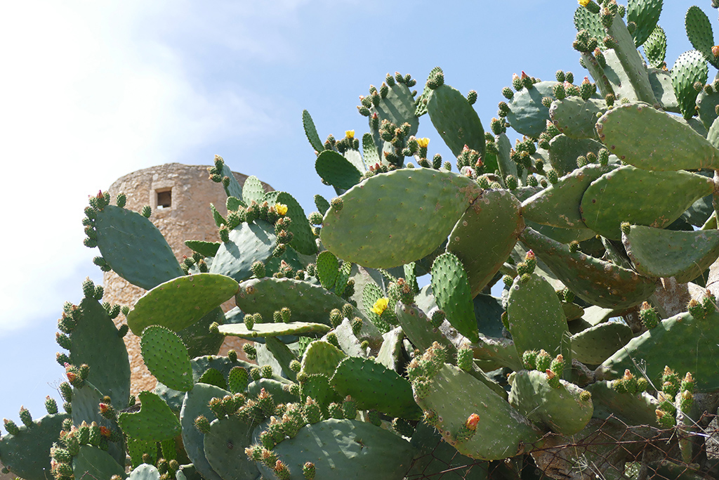
Binibassí consists of a handful of houses built in the 16th Century. Also, there is a defense tower and the impressive Binibassí estate. A signpost indicates the way to Sóller, Fornalutx, and Biniaraix.
If you don’t mind extending your hike a bit, you should definitely visit the latter settlement. Actually, it is an old Arabic farmstead that belonged to Count Hug d’Empúries after Mallorca was conquered by Jaume el Conqueridor in 1229.
As you take the route toward Fornalutx, the landscape is peppered with watermills from the 15th and 16th centuries. Slowly, the ascent begins, and the views are getting more and more spectacular.
Finally, you get to Fornalutx’s cemetery.
To go back to Sóller, first, take the Ma-2120 road. As you reach a bifurcation, turn right following the sign “A Sóller a peu per Binibassí”. At the end of this road, turn left and just follow the path to Binibassí and then continue to the Plaça de la Constitució, where your hike had begun.
Map
A Circular Hike at Fornalutx
How to Get There
There is no direct bus between Palma and Fornalutx. Nevertheless, the connection is easy and reliable at Sóller, respectively Port de Sóller. On weekdays, the first bus #204 leaves Palma at 6.30 a.m. and reaches Sóller in less than an hour. Until 9 p.m., buses are going every half an hour respectively after 6 p. m. by the hour.
You have to take the significantly smaller bus #232 from either Sóller or Port de Sóller. Once you’re on the winding hill roads, you’ll understand why bigger buses had no chance.
Prepare for…
…a route of about eight kilometers in total with a net walking time of around two and a half hours. The high difference will be approximately 450 meters.
The walk is not very difficult and is mostly on good trails. Nevertheless, it’s always recommended to wear hiking boots with high shafts that also protect your ankles.
Also, there are parts where you have to walk alongside the road, hence, beware of the traffic.
Ready, Steady, Go
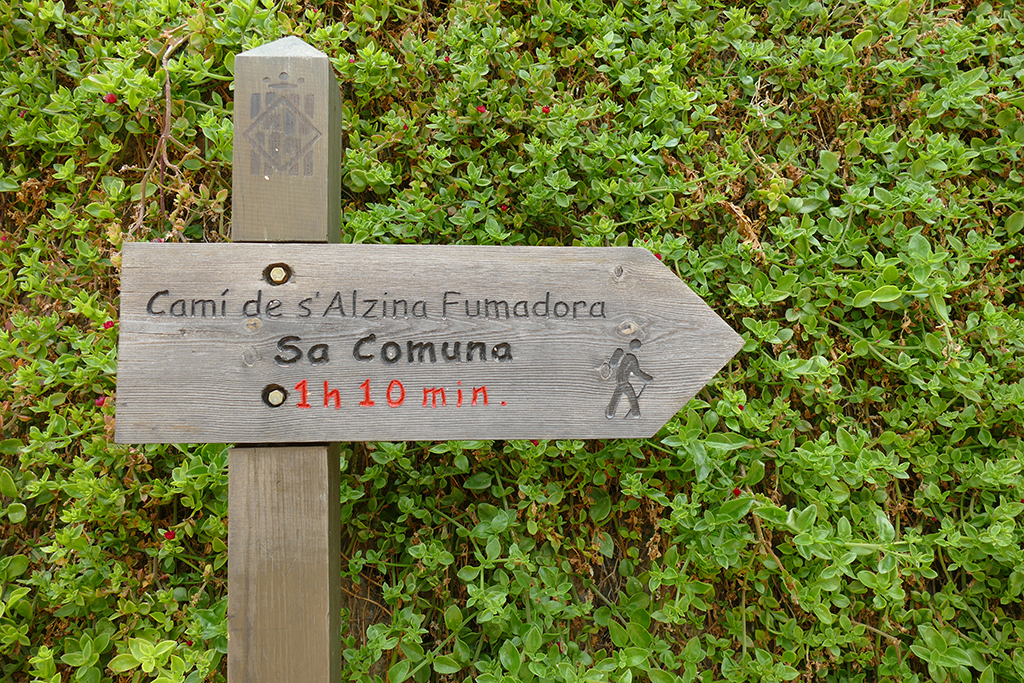
The hike starts basically right at Plaça d’Espanya, from where you walk up the staircase on the west side of the parish church. This leads into a long, narrow street to the left called Carrer Tramuntana. Keep going until you get to a sign Camí de s’Alzina Fumadora, Sa Comuna.
The Camí de s’Alzina Fumadora now meanders steeply upwards along terrace walls, citrus trees, grapevines, carob, and olive trees.
After another five minutes, you will reach the freeway Ma-2120.
Out of Fornalutx
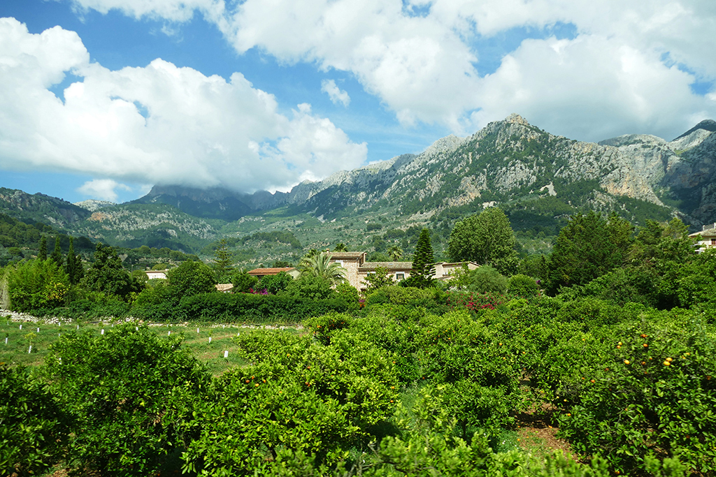
As you cross the freeway, a stepped path continues very steeply upwards in tight bends. To the north, there is a magnificent view of the colossal south face of the almost 1,400-meter-high Penyal des Migdia, the Coma de n’Arbona valley, as well as the Serra de Son Torrella mountain range. You can even make out the Serra d’Alfàbia and the Teix massif near Deià.
At a green iron gate, you reach a wide path from where a stepped path continues to the right. After a steep ascent, you reach a bifurcation. From here, you continue straight ahead in very steep serpentines – just mind the wooden post arrow. To your left, you will notice a group of holm oaks overlooked by a 20-meter-high tree. This magnificent example of a holm oak is the Alzina Fumadora.
The slope continues up in steep curves. Eventually, you’ll reach the freeway Ma-10 at kilometer 43. Turn right and walk alongside the road before you short turn left at the sign Pla de sa Bassa, 25 min.
A path now leads left after to a small square with a stone cairn, and from there again left onto a wide path.
A moderate ascent leads to a picnic area with holm oaks and pines, and from there straight on to a green water reservoir. After a few meters, you will reach a bifurcation with a wooden post arrow pointing right.
Saddle Up
This route leads in the direction of the mountain Puig de sa Comuna and the plain of Pla de sa Bassa. To continue on the circular route, however, you turn left. After a few minutes, you get to a saddle. From here, the trail meanders down into the valley in a few bends. You stay on the main path so that you get to an open gate and the Ma-10. Unfortunately, from here you have to walk about one kilometer alongside the road to the Mirador de ses Barques. Be careful, as there might be some traffic.
From the Mirador de ses Barques, you have a wonderful panoramic view of the valley of Sóller, the harbor bay with its two lighthouses, the beach of Platja d’en Repic, and the Mediterranean Sea.
Right from the Mirador’s parking lot begins the descent to Fornalutx. Posts and cairns will guide you along the trails and wide slopes. Therefore, you cannot get lost, nevertheless, you’ll have to cross the Ma-10 three times. Finally, you turn onto the Ma-2120 road. At the first bifurcation, you turn right into the Camí de Balix, which leads you all the way to the old town of Fornalutx.
Map
Getting Around by Public Bus
Mallorca has a truly amazing, comprehensive network of public transportation. It’s not only easy to move around in the capital Palma. You can get to almost every small hamlet by public bus. There are various connections per day from early morning till night.
To have a schedule on hand, you can download it from the bus company’s website. Transportes de les Illes Balears – short tib – has a very informative website in five languages.
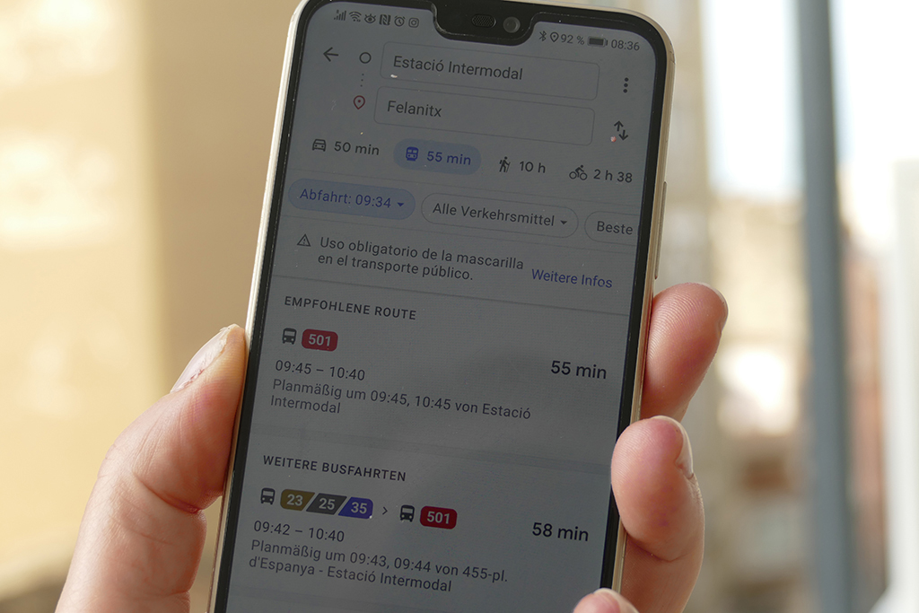
However, for a quick check, also Google Maps is really great. It doesn’t show you only the best, next available bus, but also the following ones.
Saving Time, Saving Money
Depending on the distance you’re travelling, single tickets are between 3 and 9 €uros. You can buy the ticket from the driver. However, he’ll accept only bills of up to 20 €uros.
Also, if you pay with your NFC-equipped debit or credit card, you don’t have to worry about small change, and more importantly, you’ll get a remarkable discount.
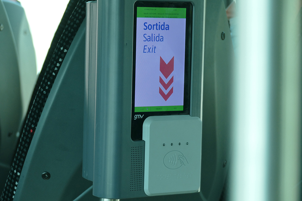
In case your card is not equipped with Near Field Communication – short NFC – you can simply obtain a so-called intermodal card, for instance at the Estació Intermodal in Palma, and just charge and recharge it as needed. This way, you’ll get the same discounts. These discounts depend on the fare – the cheaper the ticket, the smaller the discount, i. e. if your fare is 3 €uro, you get 10%. For a long ride that normally costs 9 €uro, you get 60% which you have to admit is pretty amazing.
These hikes were only some of the many amazing tours and activities during my nine days on the island of Mallorca. To read more about my stay, go to the main post and take your pick! There you’ll also find valuable general information that will make your own trip much smoother and more enjoyable.
Pinnable Pictures
If you choose to pin this post for later, please use one of these pictures:
Note: This post is being regularly completed, edited, and updated – last in August 2025.
Did You Enjoy This Post? Then You Might Also Like These:
24 hours in BARCELONA
Guide to SEVILLE – Three Days Right Where Andalusia’s Heart is Beating to the Rhythm of Flamenco

One Week in MALLORCA – Guide to the Island’s Mesmerizing Hideouts
EL COTILLO – the Most Beautiful Village of Fuerteventura
Guide to GRANADA – The Heart And Soul of Andalusia
Day Trip to the DUNAS DE MASPALOMAS and PUERTO DE MOGAN
Day Trip to San Cristobal de La Laguna and the National Park of Anaga
LA GOMERA – How to Explore the Canaries’ Ravishing Wild Child by Public Bus
Hi Renata,
We really enjoyed reading this guide. It’s very detailed and actually helped us to plan part of your hiking trip.
We found the info on Sant Elm to be particularly helpful.
If you or your readers are interested, we have written about our 9 favourite hikes in Mallorca: https://travelmademedoit.com/best-hikes-in-mallorca/
This guide covers some other great hikes in Mallorca, so we hope it’s helpful!
We love your blog, keep up the great work!
Many thanks, Dan & Beck
Thanks so much for your input – now even more dedicated hikers can…take a hike 😉
Nnniiiiccceeeee…these are very easy, to be honest. I don’t tick well with complicated hikes…I just end up regretting why I even started on them!
Mallorca is one of the places in Spain that I really want to visit. It looks like so nice! So clean!
Off the beaten tracks, it’s really, really nice 🙂
I like hiking, but I definitely need an easy one with lots of scenic stops. This one seems like my husband and I could handle it. Thanks.
These hikes are beautiful and so peaceful! I would love to be able to do these someday!
I am always up for a nice hike. It’s been awhile since we’ve been on one though.
Wha a great hiking adventure you had. The summit was truly magnificent. It is so nice that after that exhausting hike, you will be welcomed by a very unwinding view on top. The town next to it also looks so postcard-friendly in every corner
Thanks for touring us around
Although I lived for six months on the black volcanic island of Tenerife, I know nothing about Mallorca. Hiking is one of my favorite things to do, and, looking at your beautiful photos, I can now imagine how great Mallorca is for this activity. Moreover, the island has an impressive historical architectural heritage!
How cool – the Canary Islands are on my list for next winter – so stay tuned 😉
This is a nice detailed post around the hike. I wanted to ask do we need to carry some insect repellant or are there any powerful plants that we might be aware of?
That’s a very good question. I personally didn’t even think about that – and wasn’t bothered by any bugs.
It seems to me that sturdy shoes would be in order for those uneven paths. However, it would be a wonderful trek.
These are some beautiful trails to hike. Thank you for sharing this information.
Thanks for sharingthis beautiful pics. Your post is so detailed that I already imagined myself traveling already. Nice one.
Great place to hike and also see the animal. Looks like you had so much on this trip!
Fransic – https://www.querianson.com
Never heard about this place , Such a beautiful place to visit after the pandemic. Thanks for sharing with us,.
I would love to hike all of those trails. I’ve always loved exploring nature in new places. These are all wonderful spots.
Thanks for this comprehensive guide! I’d love to visit Mallorca someday soon. This guide could be helpful.
The views are breathtaking, I am not one for hiking all all the physical activities but i would do so just for the beautiful scenery. I would love to see the animals too
I’d love to head here for a hiking trip the sant elm route reminds me of a mix between sardinia around pedra longa and some of the greek islands. Great post… I need to get planning
I love hiking and these hikes in Mallorca seem easy and fun to do. Also, I love visiting World Heritage Sites so It would be wonderful to visit Serra de Tramuntana . The symbiosis between natural and human factors would be a thing to see.
These hikes look fantastic! Mallorca is beautiful
I am so planning on Mallorca this fall, your hikes give it even more appeal in my eyes
Thank you – I’m sure you’ll have a wonderful time!
I absolutely love hiking so I really enjoyed this post! There seems to be so many hiking trails there, gives you a nice variety of scenery! You really took some nice photos as well.
Wow, look at that wonderful view with the ocean in the back. Mallorca seems the gold medal of climbing when you take on the chllannge. So beautiful!
I don’t know how long I would last but I would so try this. Mallorca looks beautiful!
It is just mesmerizing 🙂
Your post is very detailed, I honestly feel like I traveled with you. I am a cardiac patient so I can’t hike but I love see all these hiking photos.
So sorry to learn this. But then, the beaches would be for you – very relaxing 🙂
Love this, thanks for sharing 🙂 its like we’re hiking too with all those wonderful details and photos!
I love Mallorca, I will have to keep this in mind next time I visit! Thanks for sharing.
I always think that the best way to travel and explore a place is by hiking. The wildlife on the trails look amazing and I would love to visit Mallorca. Also, I think I will add Ruta de Pedra en Sec to my list along with the other hikes too. Such lovely trails and the views look pretty.
Yes, the hikes gave me a totally different perspective on this otherwise quite touristy island 🙂
This looks like such an amazing hike. I just know it looks even more gorgeous in person.
Yes, but I’m afraid it’s like that with most places, isn’t it 😉
I have to agree with you regarding this. Sometimes, our cameras don’t capture the beauty of a place in its entirety.
This is Amazing, would love to go to Mallorca again and to explore more. Binibassí looks super cute.
It’s always been my dream to hike, I love this place! It’s so beautiful.
I’m a complete newbie when it comes to hiking, but I’d try any of these just for the views! Puigpuyent is probably my favorite; that panoramic view is incredible and the historic ruins make a fascinating stop.
I’m not a pro, either, therefore, I’m introducing the really easy trails 😀
I’m not a pro, either, therefore, I’m introducing the really easy trails 😀
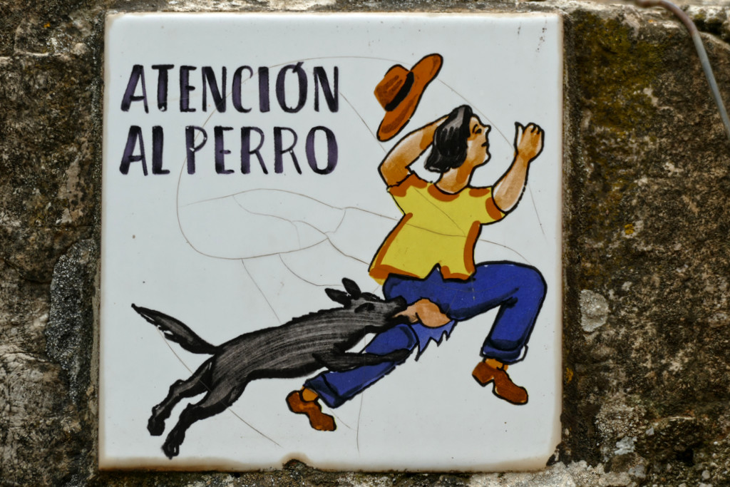
I love that you were able to encounter wildlife along the way. I couldn’t help but notice how funny that dog sign is; quite graphic.
What a wonderful and extensive guide you have prepared for Mallorca. I adore the dry stone path, how cool is that!!??
Hiking has never been my thing, but just looking at your photos and reading the post, I feel the urge to try it. You got some lovely shots! Lovely!
I hated it when I was a child, but the older I get the more I’m enjoying it 😉
I never tried hiking before, but this looks like a great experience to have! Those places you visited were so beautiful!
Beautiful country. I love destinations away from the big cities. You really feel like you can get to know a place away from all the tourists.
It was amazing being away from the crowds in such a touristy place 🙂
You found some great spots to hike when you visited Mallorca. Good to know that there are lots of hiking options in addition to the long distance Route de Pedra en Sec. I am sure that hiking in almond season would give us great hiking weather and some amazing views. Nice to know that most of the hiking paths have some kind of markings to help you follow the route. Lots of great paths to follow!
Yes, there are those markings, but you have to look closely to see them. I still did some detours here and there 😉