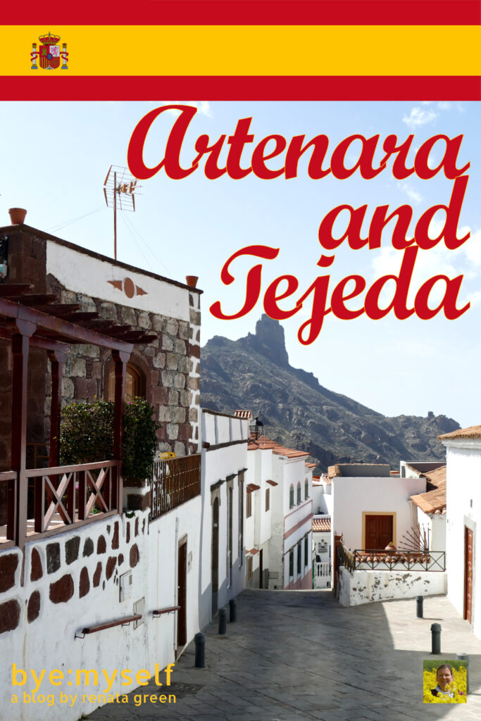
It really doesn’t matter what else you are planning to do on the island of Gran Canaria – the day trip to Artenara, the island’s highest village, and Tejeda, one of the most beautiful hamlets in all of Spain will be the absolute highlight of your trip – literally.
World’s Gran Canaria’s End
While there is a regular bus connection to basically every hamlet in Gran Canaria, to Artenara, there are two buses in the morning, one in the afternoon, and a last one in the evening. That’s it. On Sundays, there are only two: One in the morning, another one in the afternoon.
And although this is far more than in many places in the US, it prevents you from just making up your mind on short notice and off you go. Especially if you want to combine your visit to Gran Canaria’s highest village with another place, your planning has to be a bit more thorough.
An alternative is going there by car, obviously. But I haven’t driven a car for decades and the serpentines up the mountains to Artenara are certainly not an ideal route to test what’s left of my driving skills.
Hence, I checked the schedules and we took the bus. First, we had to go to Teror, a picturesque village that I’m introducing in a separate post. From there, we took the first coach to Artenara. It was just us. And the driver, obviously.
Then, as we continued our day trip two hours later on the second morning bus, it was just us again. And the driver. The same driver as before.
I think this explains why the bus company Global doesn’t overdo it with the connections to Gran Canaria’s End.
Artenara
“We are such a dream team when it comes to outings”, mumbles Mimi sarcastically. Ever since we left Teror, she feels nauseated – despite the pills she’s now taking before each of our day trips. No wonder she’s not well since the bus keeps winding up the mountain in narrow curves. The driver seems to be a restrained person, taking the curves in elegant bows.
He is driving safely. But he is driving in serpentines. Also, he is driving uphill. And this is where I come into the picture: Approximately since I turned 30, I’ve been suffering from acrophobia. Just to be clear, that’s fear of heights. Hence, although the views of the valleys below and the Atlantic ocean in the backdrop are majestic, to me, they are also terrifying. I wipe my hands on my pants. They are wet from cold sweat.
Mimi is right, we are such a dream team when it comes to outings.
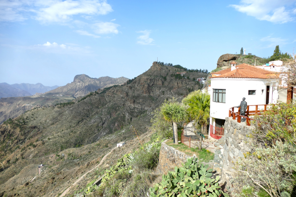
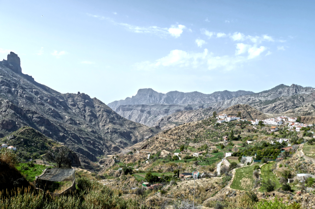
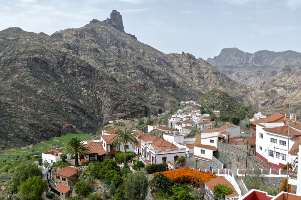
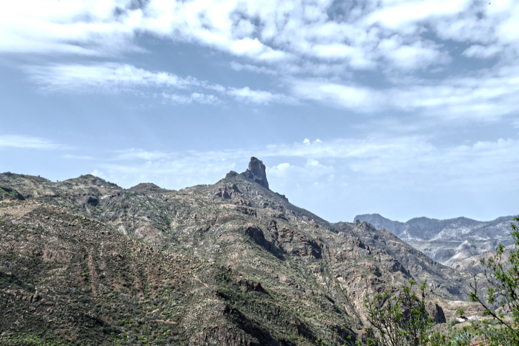
Artenara is located on the western peaks of Gran Canaria, 1,270 meters above sea level. This makes it the island’s highest municipality. Albeit, the district’s maximum altitude is at Montaña de los Moriscos, 1,770 meters above sea level.
This makes Artenara one of the island’s municipalities with the biggest territorial unevenness. Also, it’s the least populated settlement on the island. Quite some superlatives for such a small place.
Artenara’s History
The history of the municipality of Artenara dates back to pre-Hispanic times when the native Canarios lived in the cave dwellings of Acusa, Tirma, Risco Caído, and the village of Artenara, obviously. After the island’s conquest in 1478, the colonizers from Spain and Portugal settled here. They continued the local agriculture. To this date, potatoes, grapes, and citrus fruits are cultivated in the area. However, there are also goat farms. After all, Artenara’s cheese is famous. With Las Lajas and Las Lajitas, there are two artisanal, award-winning cheese dairies.
In the 19th century, the village suffered a strong economic decline due to long periods of drought. Famine forced many of the inhabitants to emigrate. Migration to the coastal areas increased in the 20th century as jobs in the tourist sector attracted the rural population.
Meanwhile, the local government acquired land for reforestation. Finally, in the last decade of the 20th century, they achieved to create a biosphere reserve that unites ecological aspects with economic and social development.
In recent years, Artenara has experienced a boom in rural tourism. Also, visitors can rent one of the iconic cave houses. In 2021, Artenara was voted second in the competition for Spain’s Capital of Rural Tourism.
The fantastic hiking and cycling facilities around Artenara contribute significantly to the village’s popularity.
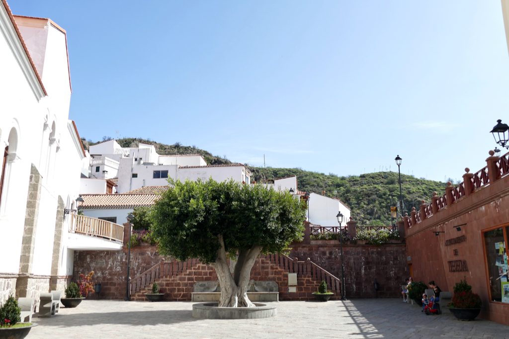
Tour of Artenara
You probably guessed so, the center of Artenara is not very big, hence, if you’re there just to see the village, you can comfortably do so in the two hours between the morning buses. You’ll only miss out on a visit to the cave museum Museo Etnográfico Casas Cuevas de Artenara since they are opening only from 11.30 a. m. to 4.30 p. m. – I mean, who does that?! But if you absolutely want to see it, you can take a cab to Tejeda instead of the bus. It’s just a ten minutes ride, therefore, it shouldn’t be too expensive.
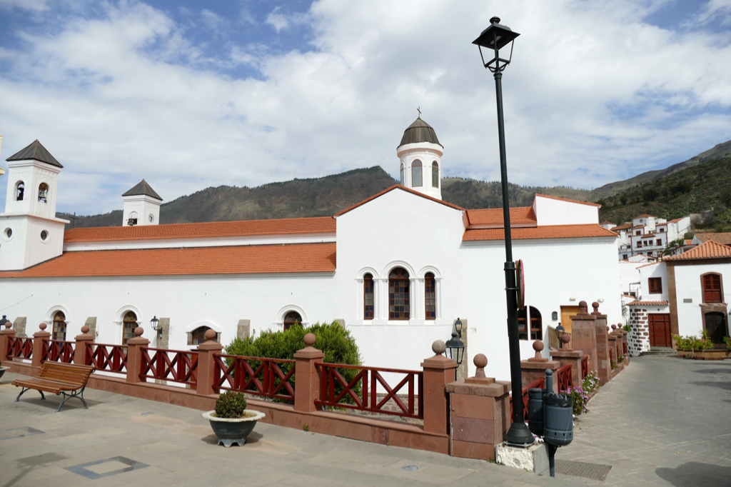
We began our tour at the bus stop, obviously. Walking down the Calle de la Cuevita, we admired the San Matias church only from the outside as we headed for the two outlooks on the village’s southern edge.
By the way, the first chapel of Artenara was not built until 1630. However, today’s church dates from the years 1864 to 1872, but was not completed until the 20th century.
The church is open for touristy visits from Monday to Sunday between 9 a. m. and 3 p. m., nevertheless, you are requested to refrain from touristy visits during the church service on the first and third Sunday of the month at 11 a. m.
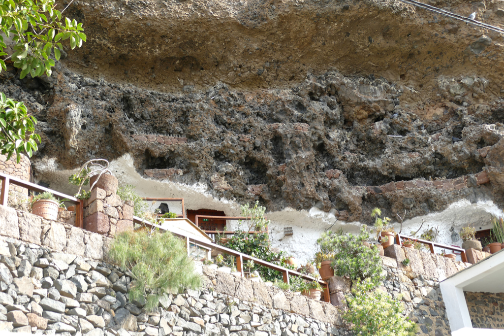
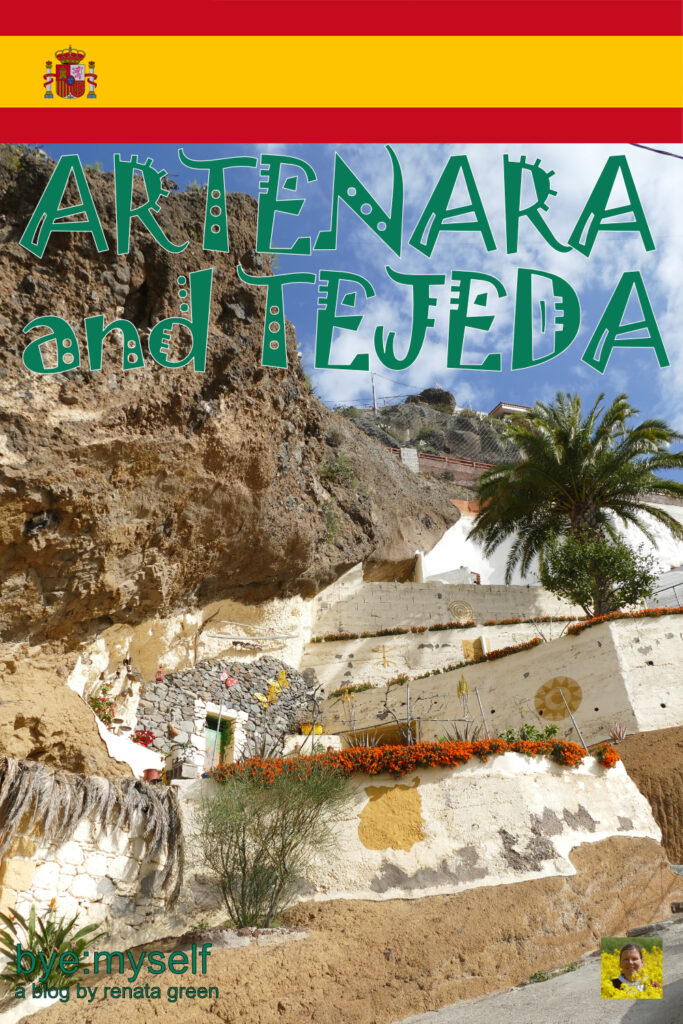
Caves
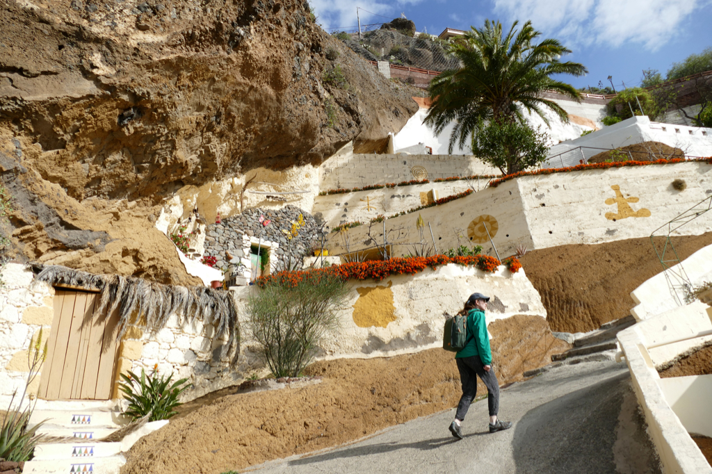
Until the 1930s, there were just a couple of houses in the vicinity of the church. Back then, the majority of Artenara’s population lived in so-called cave-houses. Those were dug into the steep slopes of the Caldera.
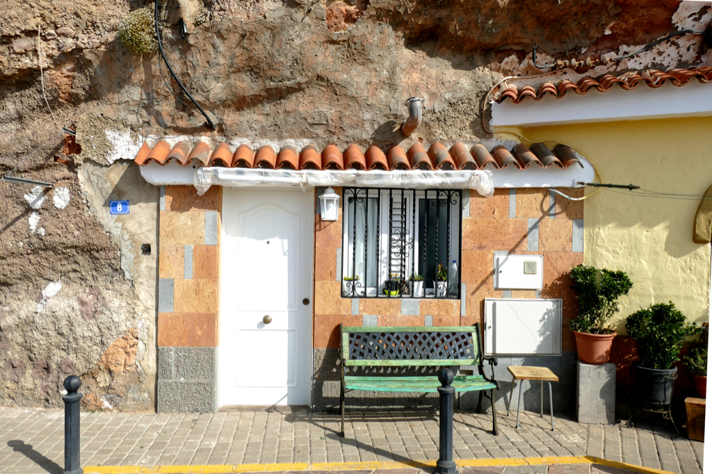
Although the times they are a-changin’, the caves are still used for residential, agricultural, and even tourist purposes. Actually, it’s probably the most comfortable and at the same time eco-friendly way of housing since these structures maintain a temperature between 18°C and 20ºC throughout the year. Therefore, they shelter the inhabitants from the cold of winter and cool them in the Canaries’ sweltering summer heat.
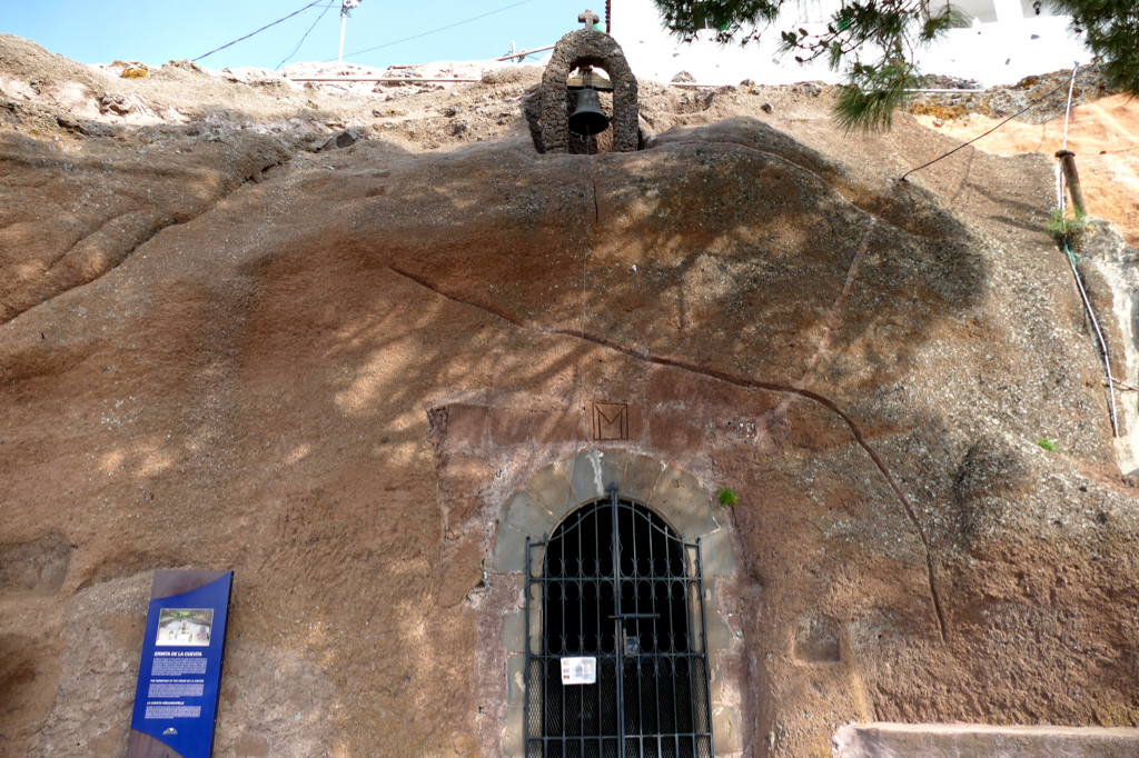
Eremita de la Cuevita
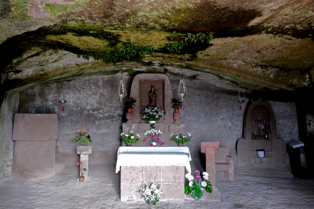
One of Artenara’s most outstanding attractions is the cave chapel Eremita de la Cuevita. It was first mentioned in 1794. In the mid 19th century, it was expanded to its current size during the construction of the new church Iglesia San Matias.
Inside the cave chapel, even the altar and the pulpit are carved from the surrounding rock. Also, there is an image of Mary. This little lady is the patron saint of folklore and cyclists.
Therefore, cyclists celebrate their patron saint on the penultimate Sunday in August, and folk musicians on the last Sunday in August. On August 14, the Virgen de la Cuevita is carried in a procession from her cave chapel down to the church.
Even if you’re neither a cyclist nor a folk musician, you can visit the Eremita de la Cuevita every day between 9 a. m. and 7 p. m. If the gate should be closed, just open it.
A mass is held there every 3rd Friday of the month.
Another great attraction is the cave and museum Casa Museo Santiago Aranda. These are three cave dwellings that arguably date back to the native Canarios, hence, they were converted into an ethnographic museum where you get an idea of how those people used to live.
As I mentioned above, the Cave Museum is only open between 11.30 a. m. and 4.30 p. m., nevertheless, every day. To see cave houses from the outside, you can just walk around Artenara.
Miradores
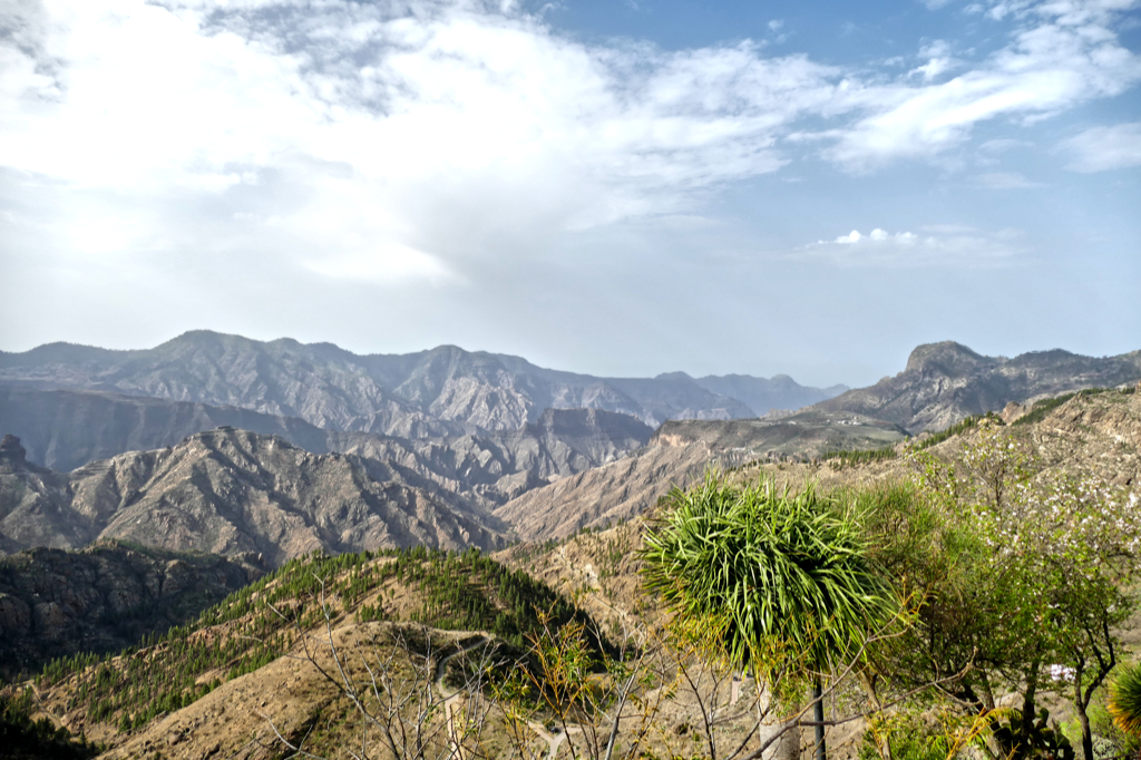
We were in Gran Canaria’s highest village, so it’s all about the views, obviously.
Coming to Artenara from the east – as the bus does – the first Mirador, hence lookout, is the Mirador de la Atalaya right at the entrance to the village. From there you can enjoy the views over the Tamadaba pine forest area all the way to the Altavista mountain.
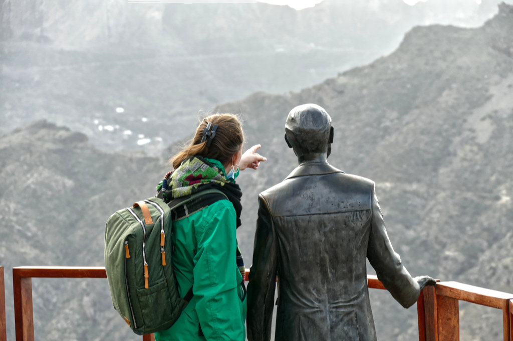
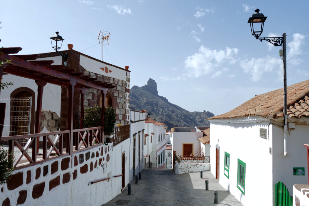
Another vantage point is right in town as you walk past the Iglesia San Matias. From the Mirador la Esquina you can enjoy the views over the center of the island. From left to right, you can spot the Roque Nublo, the Roque Bentaiga, and the Caldera of Tejeda.
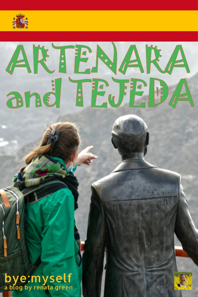
Since the Mirador de Unamuno is just a few steps further east, you have basically the same view. However, the famous poet, philosopher, and playwright Miguel de Unamuno y Jugo is charmingly photobombing your picture.
I’m introducing him in my post on Puerto del Rosario, the capital of Fuerteventura, where he left deep traces.
Walking the Calle de la Cuevita in the opposite direction, you’ll get to the highest viewpoint in this area, the Mirador de Los Poetas.
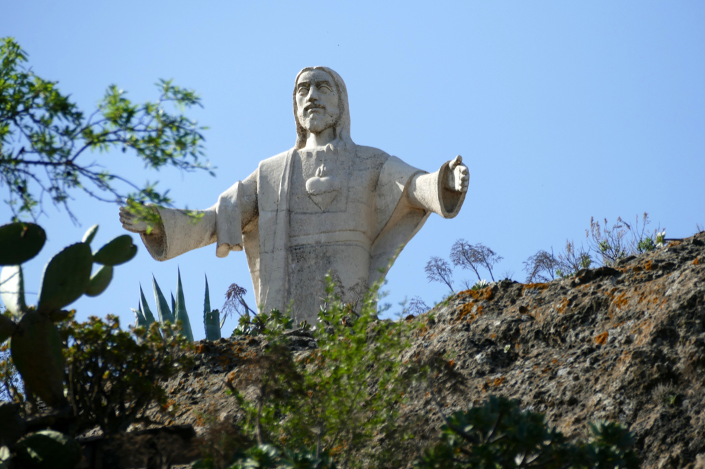
Alongside the road to Tejeda are the Mirador La Cilla and the Mirador del Corazon de Jesus that will remind you of Christ’s statues in Cali and, of course, Rio de Janeiro. This statue was created by José Luis Marrero in 1996.
If you don’t linger for too long, you can actually visit all five Miradores between the two bus rides.
Out of Artenara
The extra tour to the Riscos is rather an option when you are touring Gran Canaria by car. It is possible to go there by bus, too, however, to get to the Risco Caído, you have to take two different buses and still get only to the Barranco Hondo from where you have to walk for another hour. The Risco Chapin is much closer to Artenara, but still, you have to hike 1.5 kilometers through the mountains. And after my horrific accident in the Barranco de las Vacas on the outskirts of Agüimes last year, I’m certainly not venturing by myself into another unfamiliar gorge.
The Risco Chapin is an archaeological complex consisting of the Cueva de los Caballeros and Cueva de Los Candiles. Here you can see more than 300 engravings on the rocks.
The Risco Caído is a set of 21 caverns that were dug in a wall of the Barranco Hondo at 100 meters high. These caves were used for housing and storage. The most unique cave has a vaulted shape and an artificial hole. Through this gap, the morning light provokes a particular optical effect on the printed walls. In 2019, this structure was declared a World Heritage Site by UNESCO.
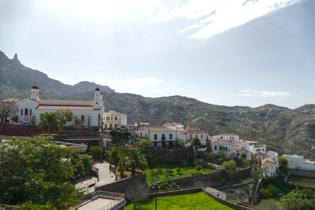
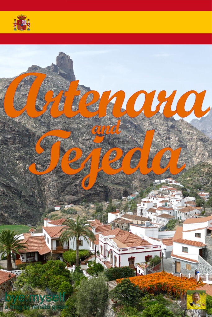
Tejeda
As I explained, when travelling by public bus, small detours to secluded places are too complicated. Therefore, after our two hours in Artenara, we went back to the bus stop and took the days only coach to Tejeda.
It is the first municipality in the Canary Islands to belong to the Association of the Most Beautiful Towns in Spain. I got to visit another one of these gems, namely Fornalutx, during my trip to the Balearic Island of Mallorca. However, Mimi and I agreed that Tejeda is cute, but not as mesmerizing as for instance Agüimes. I’m not an advocate of constantly comparing and rating. Places can be beautiful for different reasons and on different levels.
It was around noon as we got there, hence, the village appeared a bit sleepy. The views, however, were even more impressive than in Artenara, maybe because it was sunnier now so that the mountainous sceneries seemed endless.
Tejeda is located in Gran Canaria’s highlands at an altitude of 1,050 meters above sea level and is a stronghold of Canarian authenticity as it’s not ceasing to globalization.
Nevertheless, rural tourism is on the rise in Tejeda. Therefore, many of the traditional houses offer accommodation and restaurants are plenty for such a small place.
As it’s time for lunch, we choose a table at one of the restaurants on Calle Ezequiel Sánchez, overlooking the Caldera de Tejeda with the Roque Bentayga on the horizon.
Getting Nuts Over Almonds
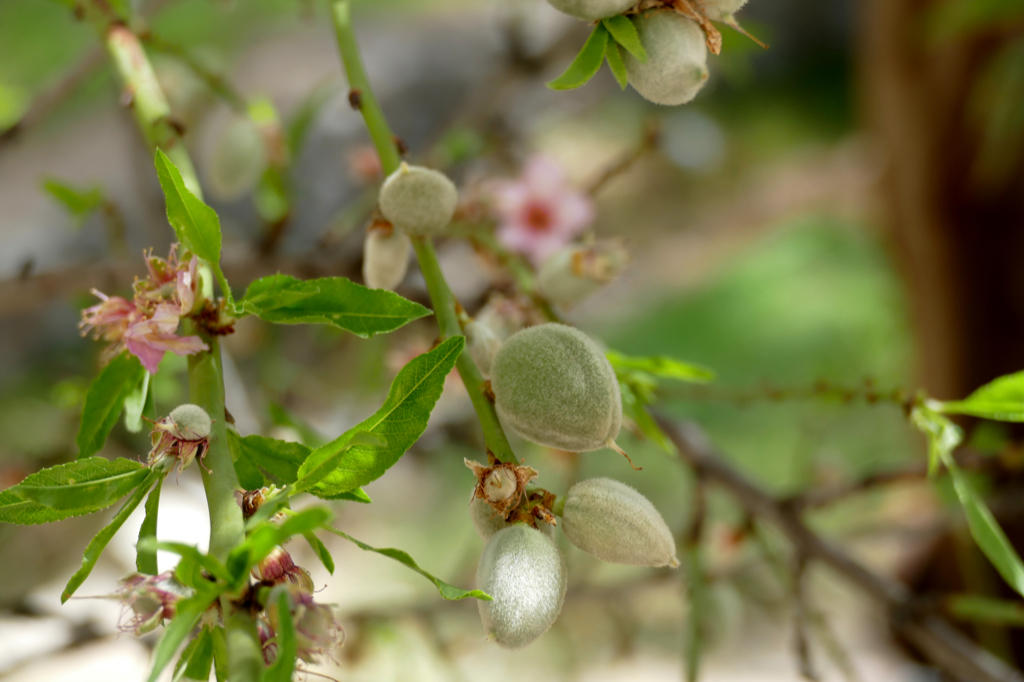
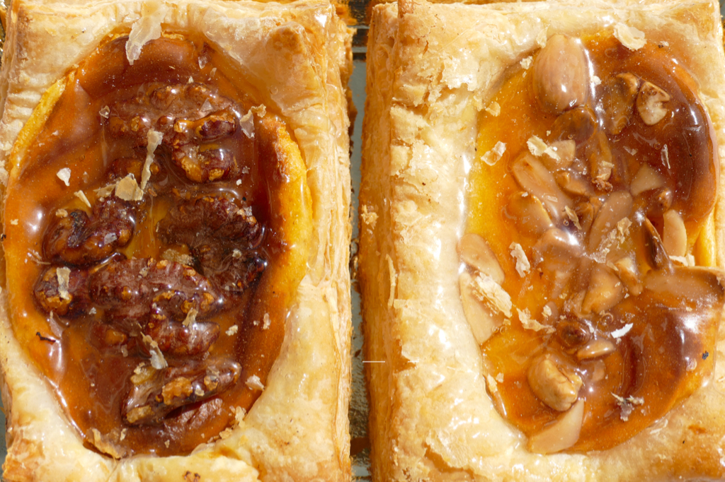
One thing I absolutely wanted to see in Tejeda were beautiful tender almond blossoms in full bloom. Apart from its height’n’beauty, the village is famous for everything almond-related. Cakes and cookies are made from sweet almonds and the bitter ones go into cosmetics. In the early 20th century, almonds and almond products granted the municipality and its people a relatively good income.
Today, agriculture and livestock farming have hardly a chance on the European market, obviously. Therefore, artisan products made from almonds are produced in small batches and sold as unique souvenirs to tourists.
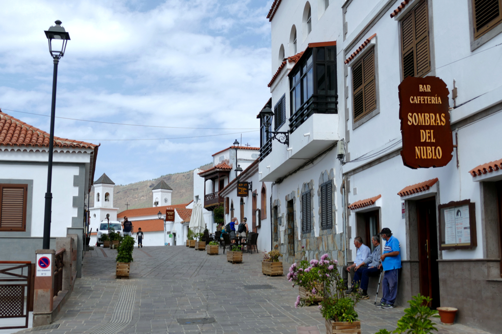
The most popular place for sampling Tejeda’s almond treats is the Dulceria Nublo on Calle Dr. Domingo Hernández Guerra. While the west side of the streets grants you a fantastic view of the valley deep, mountain high, to the east, the promenade is lined with lovely eateries.
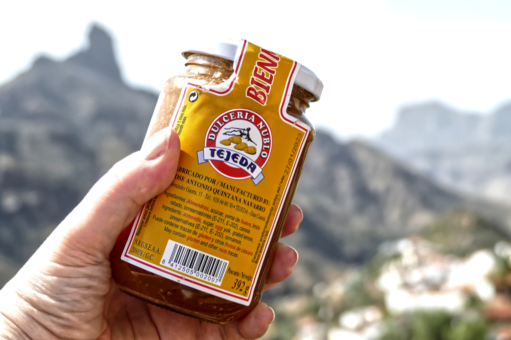
We got dessert at the Dulceria Nublo and also bought some local treats to take home. The most iconic is Bienmesabe, a spread made from honey, egg yolk, and ground almonds. Although you might find it in other parts of Spain, too, it is most popular in the cuisine of the Canary Islands.
Drought
To learn more about the benefits of herbs and other plants, you should walk up to the Centro de Plantas Medicinales de Tejeda. This center for medical plants unites the region’s enhancement of the natural and cultural heritage with a unique tourist attraction. It is located in an old school building in the Peñón ravine on the outskirts of Tejeda’s center.
This highly informative and at the same time entertaining canter can be visited every day from 10.30 a. m. to 3.30 p. m. for an admission fee of only 3 €uros.
Actually, the center was the only place where I got to see some blooming almond trees. “We didn’t have enough rain this year, therefore, the trees are not blooming”, explained a local lady. Being based in Hamburg, the lack of rain to me is simply inconceivable.
But to Tejeda, draught is not a new problem.
Until 1815, the municipality had access to the sea. Then, the southern part was divided from Tejeda and became Mogán. I’m introducing the beach area Puerto de Mogán in a separate post.
Also, the scarcity of water for irrigation has been a hindrance to economic growth and the expansion of further agricultural activities. While the shape of the valley allows the collection of water during the winter towards the west, the summit on which the village is located makes more efficient use of the water for local crops impossible.
High Energy
Speaking ’bout infrastructure: Tejeda’s first electrical installation was used in only very few homes. There was a single cable running through the entire length of the town. A diesel engine generated electricity which was used during the day to crack almonds and at dusk, it was connected to a dynamo to generate electricity.
The disconnection occurred at 10 p. m. The person operating the motor had to notify the neighbors of the disconnection by slowing down the motor for a few seconds. This way, the light bulbs lost their brightness which was a visual signal that the electricity would be cut off. After three turns of this signal, the inhabitants knew that they had to get their candles ready.
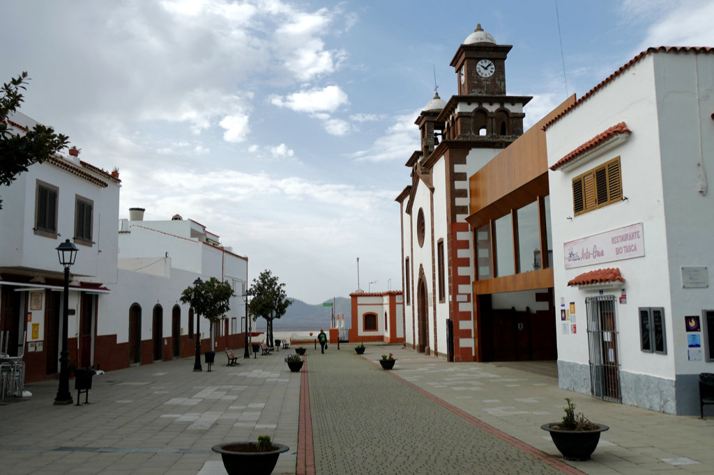
Plaza Nuestra Señora Del Socorro
Apart from the spacious terrace at the Calle Ezequiel Sánchez, there are further Miradores in Tejeda like for instance the Mirador Panorámico all the way on the village’s northern tip and the Plaza Mirador del Ayuntamiento. The latter is located in the most cultural part of the village, between the town hall, the police station, the Museo of sculptures by Abraham Cárdenes, and the church.
The current Nuestra Señora del Socorro Church was opened for worship in 1930. This church building replaced the previous one which was destroyed by fire in 1920.
The visit of the missionary San Antonio María Claret to Tejeda at the end of the 19th century left a deep cultural and religious mark. Since his evangelizing mission, Tejeda’s inhabitants have kept a great religious devotion.
Roque It
There is a comprehensive network of trails surrounding Tejeda. It was installed for communication and transportation between the different villages. Today, the trails are been maintained for hikers.
Among the most popular routes is the path to the Roque Nublo. Up there, you’ll be rewarded with majestic views. Along the way, you’ll spot many plants. Their variety and use are explained at the above-mentioned Centro de Plantas Medicinales de Tejeda.
The Roque Nublo is actually listed as a natural monument. Not far is the Roque El Fraile which translates to friar. The name refers to the monolith’s silhouette that arguably looks like a friar with his hands folded in prayer.
The third monolith in the area is Roque Bentayga, consisting of basalt stone and located at a height of 1,404 meters. Nearby is an ancient Canarian place of worship called Almogarén. This is a site of great archaeological and astronomical significance.
Cruz de Tejeda
Another iconic spot in the region is the Cruz de Tejeda. This resting place was built in 1937 about 7 kilometers east of Tejeda at an altitude of 1,560 meters. Located between the municipality of San Mateo and Tejeda, it is actually the geographical core of Gran Canaria and the crossing point of most of the old royal paths that are still used by hikers.
A large stone cross, the very Cruz de Tejeda, stands at the entry to the plateau. In the past, it served as a guiding post. Also, there is the Parador Cruz de Tejeda, an old Inn that was renovated in the style of traditional Canarian buildings. Around the Parador are some restaurants and stalls selling local products.
Going on a day trip to Artenara and Tejeda, you can easily include also a pit stop at the Cruz de Tejeda. Firstly, you can hike there. If that’s not for you, you can take one of the buses going from Tejeda to San Mateo. Taking the one at 1 p. m. gives you one hour in the village which might be enough if you just go for a walk and do not have lunch there. Obviously, you can eat lunch at the Cruz de Tejeda and eventually take the next bus at 3.18 p. m.
If you want to spend more time in the village and still visit the Cruz, that’s absolutely possible, too. As you get to Tejeda from Artenara around noon, you can spend three hours there before taking the bus to the Cruz de Tejeda at 3.05 p. m. In this case, you continue to San Mateo on the day’s last bus that leaves the Cruz at 5 p. m. This gives you almost two hours to enjoy the high life on the plateau.
How to Get There
As I pointed out above, it’s not exactly complicated to go to Artenara, however, connections are limited. Coming from Las Palmas, you always have a connection. The most direct one is via Teror. On weekdays, there are four coaches #220: In the morning at 9 a.m. and 11 a.m., in the afternoon at 2.15 p.m., and the last one at 7 p.m. To return to Las Palmas, there are buses at 4 p.m. and 8.15 p.m. Actually, there are also two buses in the early morning, but those aren’t relevant if you are on a day trip. On weekends, you can only go back on the same day at 6.45 p.m.
To follow our example and continue from Artenara to Tejeda, you have only one option: You take the first morning bus in Teror so that you arrive shortly before 10 a.m. in Artenara. This gives you about two hours to explore the village since you have to take the second morning bus to Tejeda at 11:45 a.m. This usually works like a charm. However, you cannot do the tour on Sundays since there is no bus from Artenara to Tejeda. Nevertheless, it’s only 9 kilometers, so you might take a cab if you absolutely have to go on a Sunday.
If you want to visit the villages on two separate trips, you can do so every day.
To go only to Tejeda, there are many options including a direct bus #303 that takes you there in under two hours.
Plan Your Trip
Since this is a day trip that needs thorough planning, you have to follow this only possible itinerary to visit both villages by public bus in just one day. Keep in mind that this is not possible on Sunday. To go back to Las Palmas from Tejeda, there is bus #305 going to San Mateo at 1 p. m., 3 p. m., and 5 p. m. From there you have an almost immediate connection to the Estación San Telmo by bus #303.
As I explained above, you can squeeze in a pit stop at the plateau Cruz de Tejeda by going there from Tejeda at 3 p. m. and continue from the Cruz to San Mateo at 5.30 p. m. That’s the bus that leaves at the village of Tejeda at 5 p. m. and the last one of the day.
| Start | Bus-No. | Departure | Arrival | Destination |
| Estación San Telmo | #216 | 08.00 | 08.37 | Teror |
| Teror | #220 | 09.00 | 09.47 | Artenara |
| Artenara | #220 | 11.44 | 11.58 | Tejeda |
For general information and schedules, you can check out the website of Global, Gran Canaria’s interurban bus company. Then, you can put together your individual schedule with the help of google maps.
You can pay the driver in cash – only with change or small bills – or by credit card if it’s equipped with NFC.
By the way, locals call all buses la guagua, not only those of the eponymous regional bus company.
Where to Eat
The gastronomy of the villages in the mountains offers a wide range of typical dishes. There are wonderful stews made from pork, rabbit, or goat. However, you get also all the fish dishes that are popular on the coast.
Artenara as well as Tejeda pride themselves to manufacture artisan, award-winning cheeses made mainly from goat and sheep milk.
I think I’ve been raving enough about the delicious almond products such as spreads, pies, and cookies, haven’t I?!?
Where to Stay
In relation to the villages’ respective sizes, accommodation is plentiful. Apart from rustic hotels, renting rural houses and apartments is very popular.
If you are looking for the comfort of a four-star hotel, check out the Parador Cruz de Tejeda*. Otherwise, you should find suitable lodging options on this map*:
Well-Organized Activities
Although I’m an avid solo-travelling woman, I sometimes like to join organized tours. Since I’m not driving, they are sometimes the only option to visit remote places. Also, it’s a great way to get in touch with fellow travellers.
Therefore, here are some great ideas on how to visit Gran Canaria’s mountainous hinterland:
The day trips to Artenara and Tejeda were just two of the highlights – in any sense of the word – during our week on the island of Gran Canaria. To read about the others, go to this post and take your pick!
For general information on Spain, go to this post. There, you’ll find information and tips that will make your trip much smoother and more enjoyable.
Map
This map shows you where all the interesting places are that you should see in Artenara….
….as well as in Tejeda:
Clicking on the slider symbol at the top left or the full-screen icon at the top right will display the whole map, including the legend.
Pinnable Pictures
If you choose to pin this post for later, please use one of these pictures:
Note: I’m completing, editing, and updating this post regularly – last in October 2025.
Did You Enjoy This Post? Then You Might Like Also These:
EL MEDANO – where not only the wind will blow you away

Best Things to do in GRAN CANARIA in one week
GARACHICO – ICOD DE LOS VINOS – MASCA – Touring Tenerife’s Delightful Northcoast
Guide to SEVILLE – Three Days Right Where Andalusia’s Heart is Beating to the Rhythm of Flamenco
From FELANITX to SANT SALVADOR – an Uplifting Day Trip
Guide to MALAGA – How to Enjoy the Ease of Being at the Hometown of Pablo Picasso
ALCÚDIA – Dreamy Beach on Mallorca’s North Coast
Guide to CORDOBA – the Moorish Center of Andalusia
* This is an affiliate link. Hence, If you book through this page, not only do you get the best deal. I also get a small commission that helps me run this blog. Thank you so much for supporting me!